
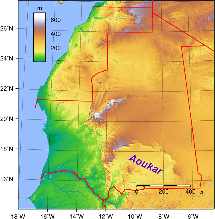
Image: Aoukar-Mauritania Topography
Size of this preview: 589 × 600 pixels. Other resolutions: 236 × 240 pixels | 754 × 768 pixels.
Original image (754 × 768 pixels, file size: 255 KB, MIME type: image/png)
Description: Location of the Aoukar basin Source: *Mauritania_Topography.png This is a retouched picture, which means that it has been digitally altered from its original version. Modifications: Location: Aoukar Basin. The original can be viewed here: Mauritania Topography.png: . Modifications made by Xufanc.
Title: Aoukar-Mauritania Topography
Credit: Own work
Author: Xufanc
Usage Terms: Creative Commons Attribution-Share Alike 4.0
License: CC BY-SA 4.0
License Link: https://creativecommons.org/licenses/by-sa/4.0
Attribution Required?: Yes
Image usage
The following page links to this image:

All content from Kiddle encyclopedia articles (including the article images and facts) can be freely used under Attribution-ShareAlike license, unless stated otherwise.