
Image: Apaporis drainage basin map-fr

Size of this PNG preview of this SVG file: 458 × 600 pixels. Other resolution: 183 × 240 pixels.
Original image (SVG file, nominally 1,101 × 1,442 pixels, file size: 1.47 MB)
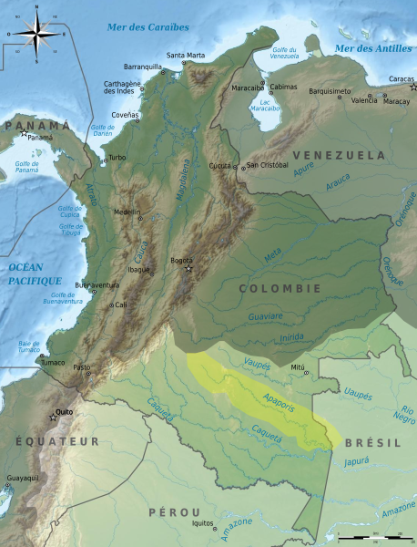
Description: Carte du bassin versant de l'Apaporis à l'intérieur du bassin versant de l'Amazone, sur une carte de Colombie. Limites approximatives !
Title: Apaporis drainage basin map-fr
Credit: Own work ; travail personnel from File:Colombia relief location map.jpg (Grundkarte Shadowxfox, Relief Alexrk2 + SRTM3, ETOPO1)
Author: Bourrichon - fr:Bourrichon
Permission: You may select the license of your choice.
Usage Terms: Creative Commons Attribution-Share Alike 3.0
License: CC BY-SA 3.0
License Link: https://creativecommons.org/licenses/by-sa/3.0
Attribution Required?: Yes
Image usage
The following page links to this image:

All content from Kiddle encyclopedia articles (including the article images and facts) can be freely used under Attribution-ShareAlike license, unless stated otherwise.