
Image: Appalachian Corridor S, Grainger County, TN

Size of this preview: 800 × 533 pixels. Other resolutions: 320 × 213 pixels | 4,032 × 2,688 pixels.
Original image (4,032 × 2,688 pixels, file size: 2.85 MB, MIME type: image/jpeg)
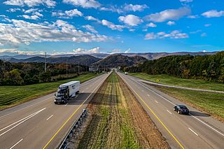
Description: Corridor S of the Appalachian Development Highway System, also designated as Tennessee Route 32, U.S. 25E, and the East Tennessee Crossing Byway, in the community of Bean Station, Tennessee
Title: Appalachian Corridor S, Grainger County, TN
Credit: Own work
Author: AppalachianCentrist
Usage Terms: Creative Commons Attribution-Share Alike 4.0
License: CC BY-SA 4.0
License Link: https://creativecommons.org/licenses/by-sa/4.0
Attribution Required?: Yes
Image usage
The following page links to this image:

All content from Kiddle encyclopedia articles (including the article images and facts) can be freely used under Attribution-ShareAlike license, unless stated otherwise.