
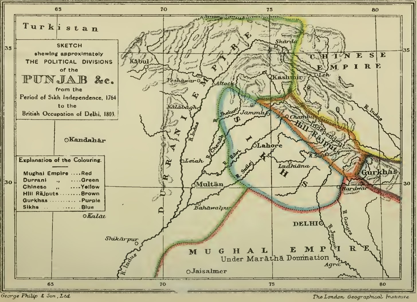
Image: Approximate political map of Punjab from 1764–1803 by Joseph Davey Cunningham
Size of this preview: 800 × 579 pixels. Other resolutions: 320 × 232 pixels | 1,455 × 1,053 pixels.
Original image (1,455 × 1,053 pixels, file size: 334 KB, MIME type: image/jpeg)
Description: Approximate political map of Punjab from 1764–1803 by Joseph Davey Cunningham and published in "A History of the Sikhs: From the Origin of the Nation to the Battles of the Sutlej" (1853).
Title: Approximate political map of Punjab from 1764–1803 by Joseph Davey Cunningham
Credit: http://pakgeotagging.blogspot.com/2020/10/
Author: Joseph Davey Cunningham
Usage Terms: Public domain
License: Public domain
Attribution Required?: No
Image usage
The following page links to this image:

All content from Kiddle encyclopedia articles (including the article images and facts) can be freely used under Attribution-ShareAlike license, unless stated otherwise.