
Image: Ar.F-T.4-C.3 139
Size of this preview: 798 × 189 pixels. Other resolutions: 320 × 76 pixels | 17,863 × 4,231 pixels.
Original image (17,863 × 4,231 pixels, file size: 10.36 MB, MIME type: image/jpeg)
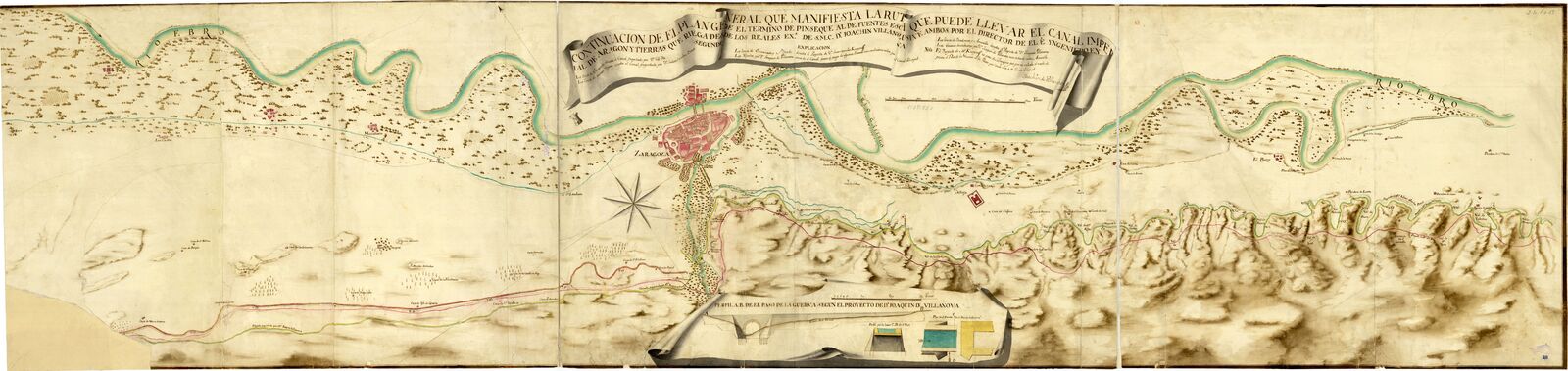
Description: Continuación de el plan general que manifiesta la ruta que puede llevar el Canal Imperial de Aragón y tierras que riega desde los reales exs. de S.M.C. Dn. Joachin Vilanova inclusive ambos por el Director de el e yngeniero en segundo / Joachin de Villanova
Title: Ar.F-T.4-C.3 139
Credit: https://bibliotecavirtual.defensa.gob.es/BVMDefensa/es/consulta/registro.do?id=93074
Author: Villanueva y Pacheco, Joaquín España. Cuerpo de Ingenieros del Ejército
Usage Terms: Creative Commons Attribution-Share Alike 4.0
License: CC BY-SA 4.0
License Link: https://creativecommons.org/licenses/by-sa/4.0
Attribution Required?: Yes
Image usage
The following page links to this image:

All content from Kiddle encyclopedia articles (including the article images and facts) can be freely used under Attribution-ShareAlike license, unless stated otherwise.