
Image: Arapahoe Cheyenne Land 1851

Size of this preview: 798 × 599 pixels. Other resolutions: 320 × 240 pixels | 916 × 688 pixels.
Original image (916 × 688 pixels, file size: 457 KB, MIME type: image/jpeg)
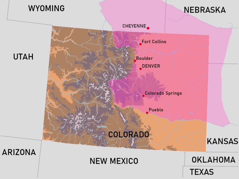
Description: This map illustrates the approximate territory of the Arapaho and Cheyenne tribes following the Treaty of Fort Laramie in 1851. The North Platt River and Arkansas River acted as the northern and southern border of this territory, respectively.
Title: Arapahoe Cheyenne Land 1851
Credit: Own work
Author: RegionalsAtMost
Usage Terms: Creative Commons Attribution-Share Alike 4.0
License: CC BY-SA 4.0
License Link: https://creativecommons.org/licenses/by-sa/4.0
Attribution Required?: Yes
Image usage
The following 2 pages link to this image:

All content from Kiddle encyclopedia articles (including the article images and facts) can be freely used under Attribution-ShareAlike license, unless stated otherwise.