
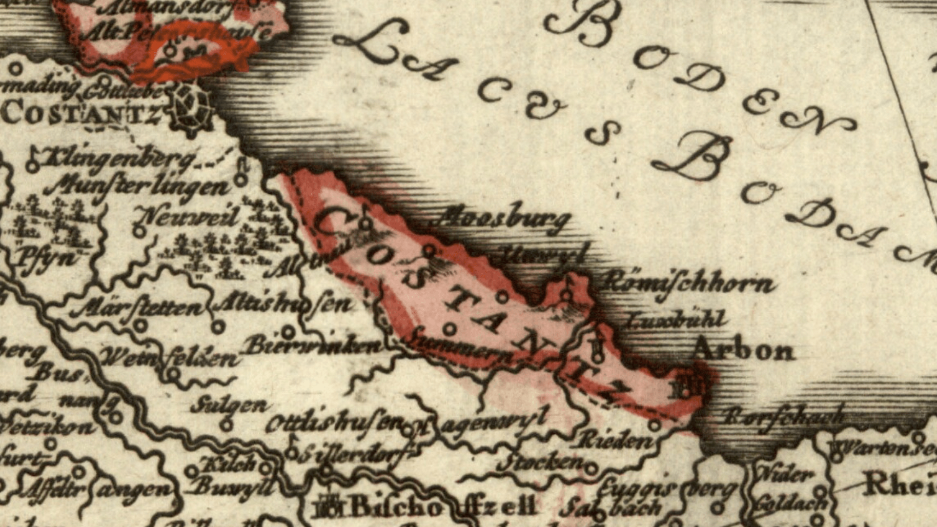
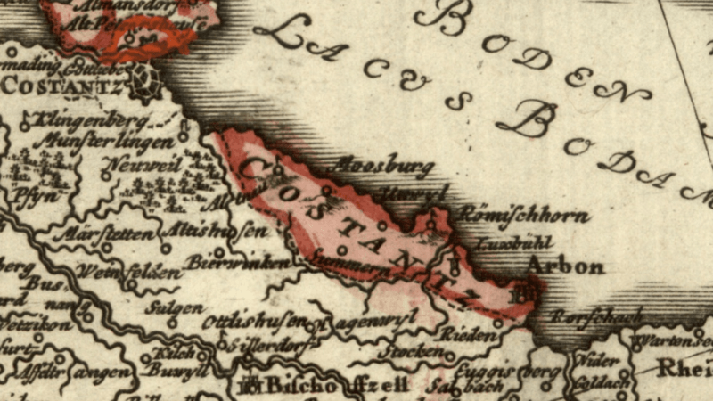
Image: Arbon (J. M. Hase Circvli Sveviae Mappa 1742)
Description: Detail cropped out of a mid-18th century map showing (in pink) the territory on the southern shore of Lake Constance, including the town of Arbon, that belonged to the prince-bishop of Constance. The prince-bishop was also lord of Bischofszell (lower part of map) although effective power over that town had passed to the Swiss Confederacy and the canton of Zurich. Cropped out of a map centered on the Swabian Circle titled Circvli Sveviae Mappa designed by Johann Matthias Hase and published by Homann Heirs (Homann Erben) in 1742.
Title: Arbon (J. M. Hase Circvli Sveviae Mappa 1742)
Credit: Moll's map collection
Author: Johann Matthias Hase (1684-1742)
Usage Terms: Public domain
License: Public domain
Attribution Required?: No
Image usage
The following page links to this image:

.png)