
Image: Argyre MOLA zoom 64
Size of this preview: 712 × 600 pixels. Other resolutions: 285 × 240 pixels | 4,220 × 3,556 pixels.
Original image (4,220 × 3,556 pixels, file size: 6.74 MB, MIME type: image/jpeg)
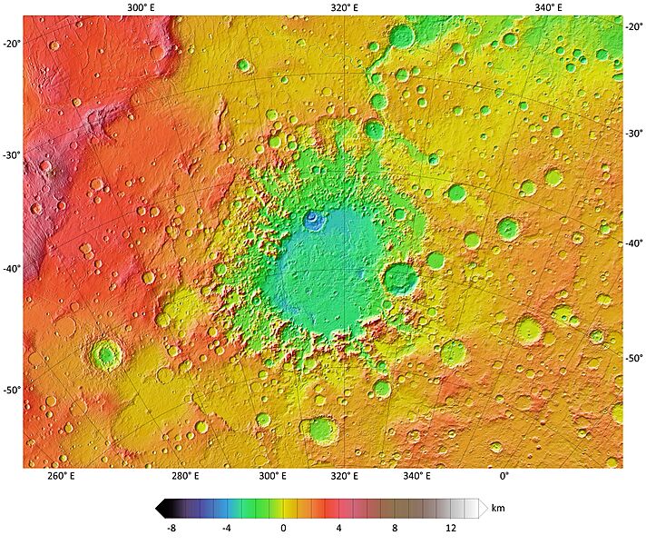
Description: A colorized topographic map of the martian impact basin Argyre, together with its surroundings, from the Mars Orbiter Laser Altimeter (MOLA) instrument of the Mars Global Surveyor spacecraft. Argyre, the second deepest basin on Mars, lies in the southern hemisphere, southeast of the canyon system Valles Marineris. Some of the features in this image have been annotated in Wikimedia Commons.
Usage Terms: Public domain
Image usage
The following page links to this image:

All content from Kiddle encyclopedia articles (including the article images and facts) can be freely used under Attribution-ShareAlike license, unless stated otherwise.