
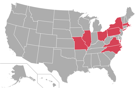
Image: Atlantic 10 Conference map

Size of this PNG preview of this SVG file: 565 × 362 pixels. Other resolution: 320 × 205 pixels.
Original image (SVG file, nominally 565 × 362 pixels, file size: 285 KB)
Description: Map of schools in the Atlantic 10 Conference
Title: Atlantic 10 Conference map
Credit: Own work, derivative of File:USA Counties.svg by the U.S. Census Bureau
Author: Spyder_Monkey
Permission: Public domainPublic domainfalsefalse I, the copyright holder of this work, release this work into the public domain. This applies worldwide. In some countries this may not be legally possible; if so: I grant anyone the right to use this work for any purpose, without any conditions, unless such conditions are required by law.
Usage Terms: Public domain
License: Public domain
Attribution Required?: No
Image usage
The following page links to this image:

All content from Kiddle encyclopedia articles (including the article images and facts) can be freely used under Attribution-ShareAlike license, unless stated otherwise.