
Image: Australian Heatwave 2017 Satellite Imagery
No higher resolution available.
Australian_Heatwave_2017_Satellite_Imagery.png (720 × 598 pixels, file size: 310 KB, MIME type: image/png)
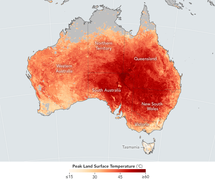
Description: Peak land surface temperatures from February 7-14, 2017, as mapped by satellite during the 2017 heatwave.
Title: Australian Heatwave 2017 Satellite Imagery
Credit: https://earthobservatory.nasa.gov/IOTD/view.php?id=89683
Author: NASA Earth Observatory
Usage Terms: Public domain
License: Public domain
Attribution Required?: No
Image usage
The following page links to this image:

All content from Kiddle encyclopedia articles (including the article images and facts) can be freely used under Attribution-ShareAlike license, unless stated otherwise.