
Image: Austria satellite Grosslandschaften markerstyle
Size of this preview: 800 × 429 pixels. Other resolutions: 320 × 172 pixels | 2,457 × 1,318 pixels.
Original image (2,457 × 1,318 pixels, file size: 2.43 MB, MIME type: image/png)
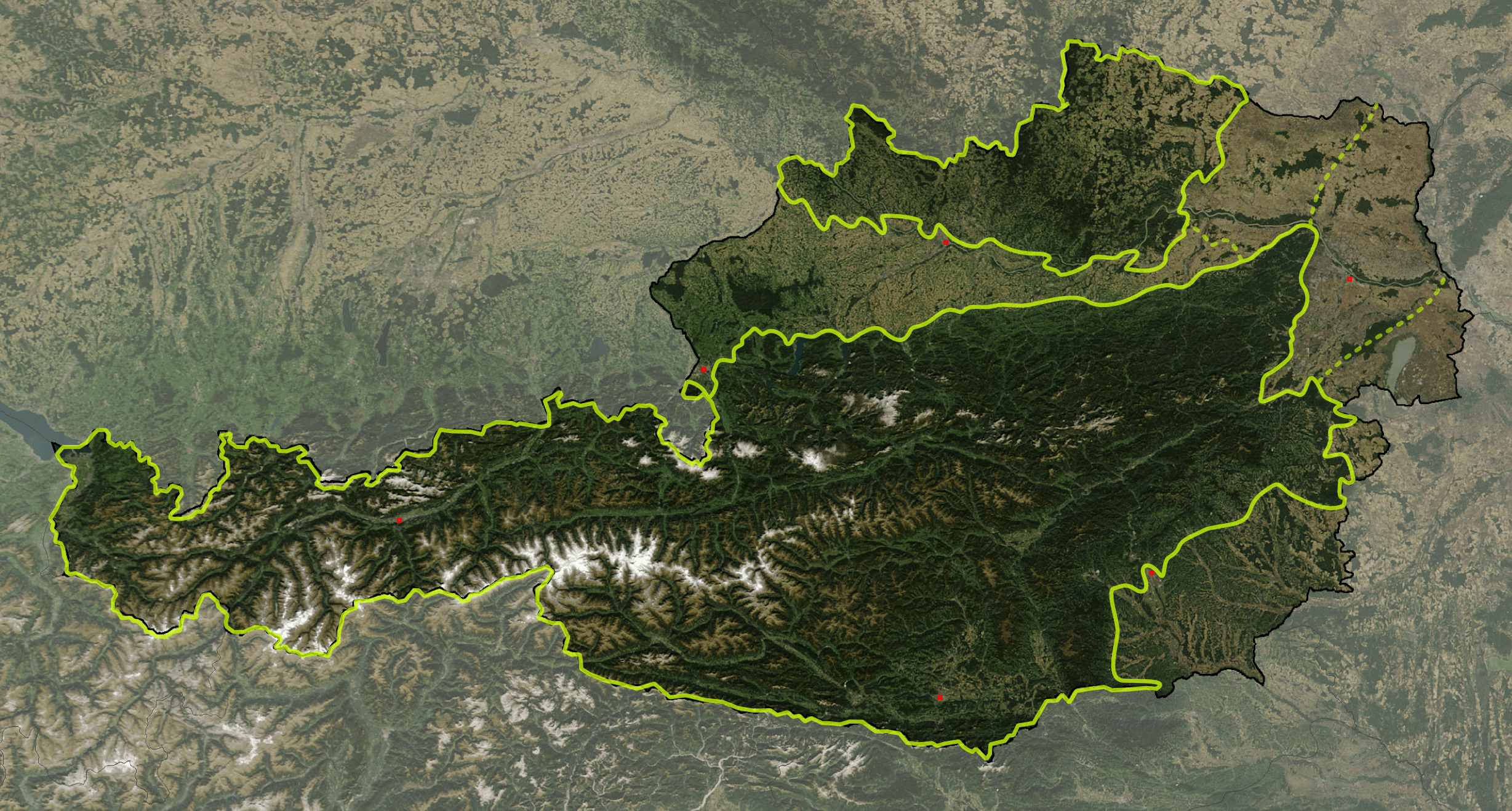
Description: Satellite image of Austria with greater landscapes: Austrian Alps, Alpine Forelands and Rim Basins, Granite and Gneiss Highlands
Title: Austria satellite Grosslandschaften markerstyle
Credit: The image is based on a satellite image from [1]. Original image: Credit Jeff Schmaltz, MODIS Rapid Response Team, NASA/GSFC. It was cropped and reduced in contrast around Austria by Michael Schmid, which is Image:Austria satellite unannotated.jpg. Borderlines added with Inkscape.
Author: W!B:
Permission: Based on a NASA image, thus in the public domain.
Usage Terms: Public domain
License: Public domain
Attribution Required?: No
Image usage
The following page links to this image:

All content from Kiddle encyclopedia articles (including the article images and facts) can be freely used under Attribution-ShareAlike license, unless stated otherwise.