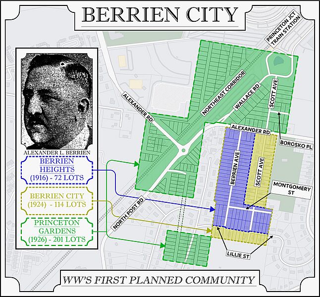
Image: BERRIEN CITY MAP

Size of this preview: 646 × 599 pixels. Other resolutions: 259 × 240 pixels | 2,000 × 1,855 pixels.
Original image (2,000 × 1,855 pixels, file size: 1.1 MB, MIME type: image/jpeg)
Description: Map of original intended lots of Berrien Heights, Berrien City, and Princeton Gardens. Created in 2021 by Paul Ligeti, who was then the Vice President of the Historical Society of West Windsor.
Title: BERRIEN CITY MAP
Credit: Own work
Author: Paulligeti
Usage Terms: Creative Commons Attribution-Share Alike 4.0
License: CC BY-SA 4.0
License Link: https://creativecommons.org/licenses/by-sa/4.0
Attribution Required?: Yes
Image usage
The following page links to this image:

All content from Kiddle encyclopedia articles (including the article images and facts) can be freely used under Attribution-ShareAlike license, unless stated otherwise.
