
Image: BNSF Map

Size of this preview: 744 × 600 pixels. Other resolutions: 298 × 240 pixels | 1,082 × 872 pixels.
Original image (1,082 × 872 pixels, file size: 70 KB, MIME type: image/png)
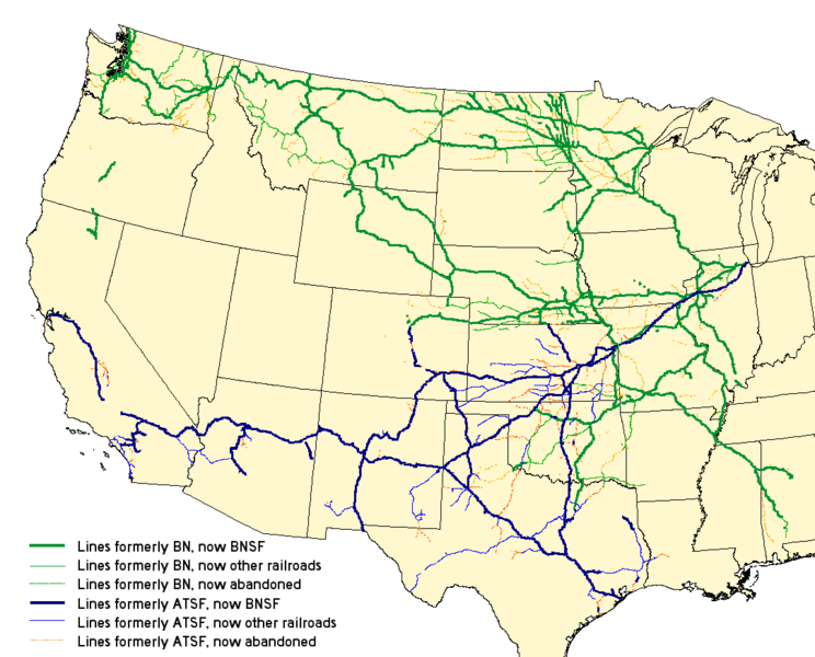
Description: Map of the merger of the en:Burlington Northern Railroad and the en:Atchison, Topeka and Santa Fe Railway to form the en:BNSF Railway. See the map legend for details. Created with Quantum GIS with data from the National Transportation Atlas Database.
Title: BNSF Map
Credit: Transferred from en.wikipedia to Commons by Quatro Valvole. This PNG graphic was created with QGIS.
Author: The original uploader was Elkman at English Wikipedia.
Usage Terms: Creative Commons Attribution-Share Alike 3.0 truetrue
License: CC-BY-SA-3.0
License Link: http://creativecommons.org/licenses/by-sa/3.0/
Attribution Required?: Yes
Image usage
The following page links to this image:

All content from Kiddle encyclopedia articles (including the article images and facts) can be freely used under Attribution-ShareAlike license, unless stated otherwise.