
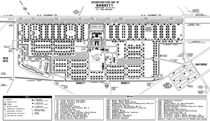
Image: Babbitt-Map2
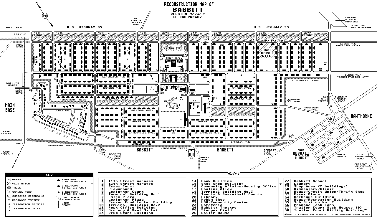
Size of this preview: 800 × 463 pixels. Other resolutions: 320 × 185 pixels | 1,280 × 740 pixels.
Original image (1,280 × 740 pixels, file size: 44 KB, MIME type: image/gif)
Description: Recreation of town layout.
Title: Babbitt-Map2
Credit: Own work (Original text: Map I created in 1991 as part of a display for the local Mineral County Museum, based upon aerial photographs, maps, and local newspaper articles.)
Author: MrNeutronSF at English Wikipedia
Usage Terms: Public domain
License: Public domain
Attribution Required?: No
Image usage
The following 2 pages link to this image:

All content from Kiddle encyclopedia articles (including the article images and facts) can be freely used under Attribution-ShareAlike license, unless stated otherwise.