
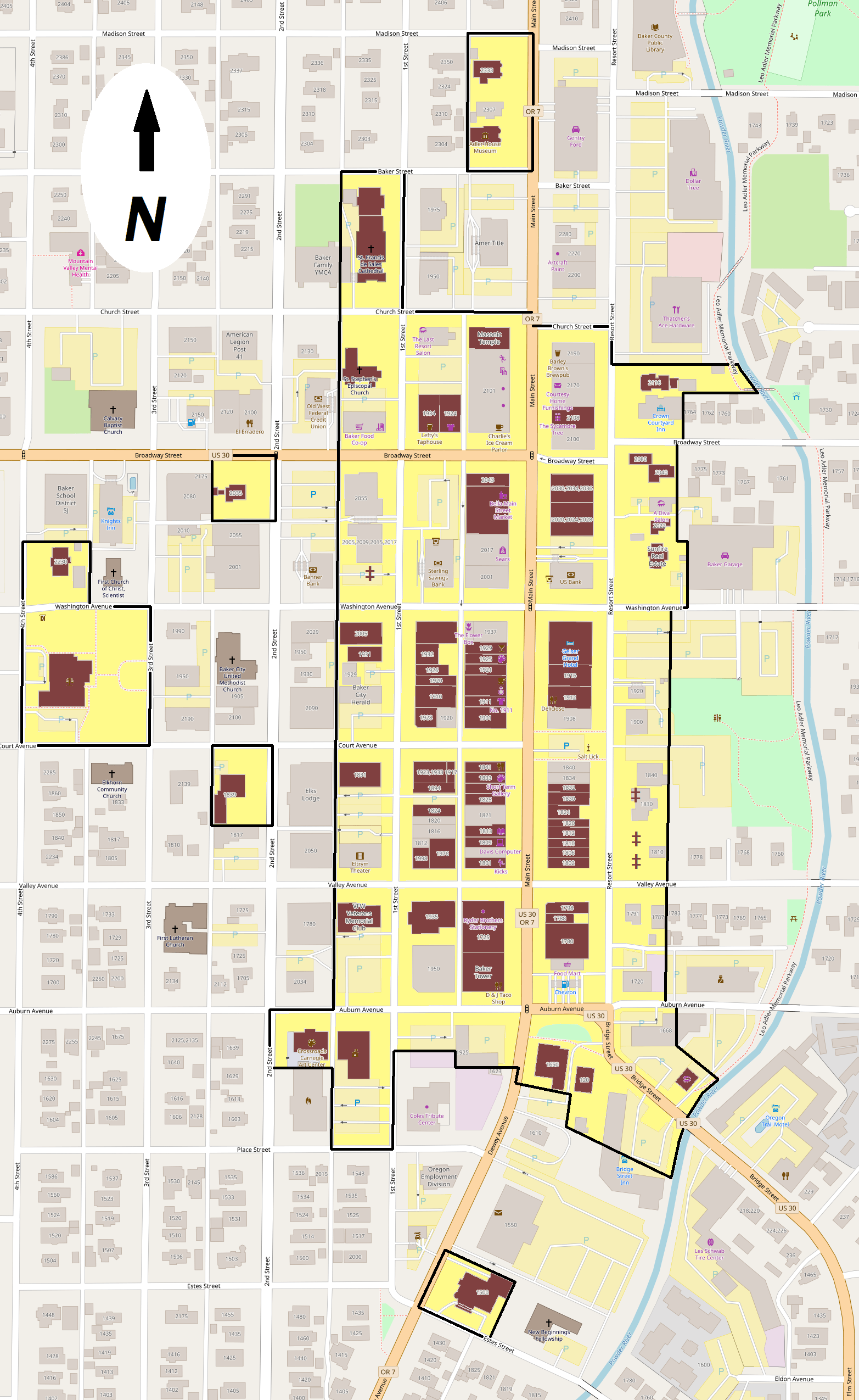
Image: Baker HD boundary map
Description: Map showing the boundaries of the Baker Historic District in Baker City, Oregon, United States. The historic district is listed on the U.S. National Register of Historic Places. Black boundary/yellow area: Baker Historic District boundaries Maroon shading: Buildings listed as contributing resources in the historic district Maroon double dagger: Marks the former locations of buildings that were identified as a contributing resources at the time of listing on the National Register, but which had been either demolished or relocated by June 2013 (date of Google Earth aerial imagery) Gray shading: Buildings not contributing in the historic district
Title: Baker HD boundary map
Credit: Exported screenshot from OpenStreetMap, with district boundary/shading and compass drawn by uploader. Location, boundary, and contributing resource data are derived from the historic district's National Register nomination form.
Author: Base map: OpenStreetMap contributors District boundaries/shading: Ian Poellet
Permission: Base map: © OpenStreetMap contributors. Current license information available at http://www.openstreetmap.org/copyright.
Usage Terms: Creative Commons Attribution-Share Alike 2.0
License: CC BY-SA 2.0
License Link: https://creativecommons.org/licenses/by-sa/2.0
Attribution Required?: Yes
Image usage
The following page links to this image:
