
Image: Balinese kingdoms map
No higher resolution available.
Balinese_kingdoms_map.jpg (729 × 438 pixels, file size: 87 KB, MIME type: image/jpeg)
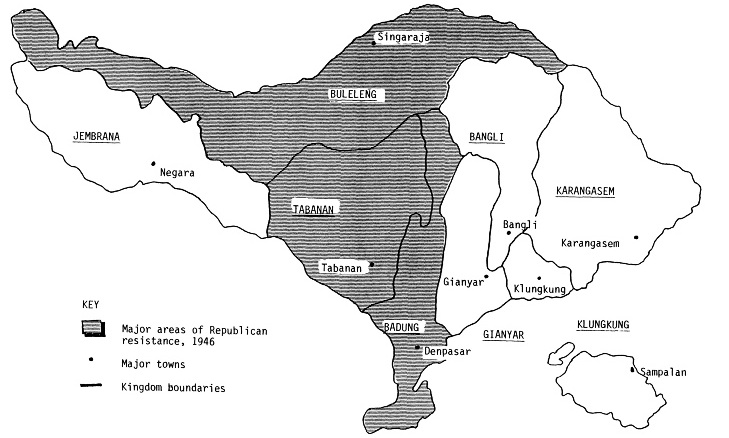
Description: The political divisions among kingdoms of Bali during the Indonesian National Revolution (1945-46)
Title: Balinese kingdoms map
Credit: Monografi Pulau Bali (Jakarta: Djawatan Pertanian Rakjat, 1955). Map found in Geoffrey Robinson's State, Society and Political Conflict in Bali, 1945-1946, published by the Cornell University
Author: I Gusti Gde Raka
Usage Terms: Public domain
License: Public domain
Attribution Required?: No
Image usage
The following page links to this image:

All content from Kiddle encyclopedia articles (including the article images and facts) can be freely used under Attribution-ShareAlike license, unless stated otherwise.