
Image: Balkan peninsula line
No higher resolution available.
Balkan_peninsula_line.jpg (558 × 530 pixels, file size: 169 KB, MIME type: image/jpeg)
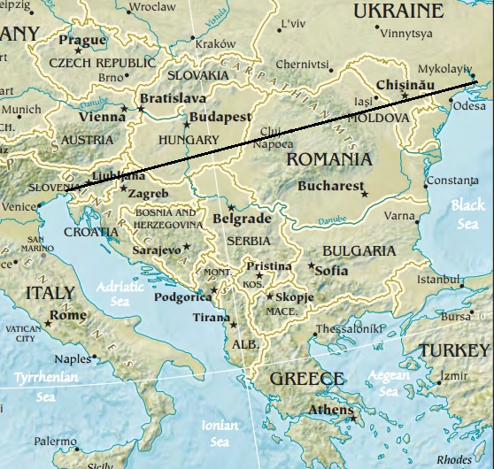
Description: Map of the Balkan peninsula, showing the line stretching from the northernmost point of the Adriatic to the northernmost point of the Black Sea. Made from Europe map at The Central Intelligence Agency World Factbook, which is in the public domain.
Title: Balkan peninsula line
Credit: https://www.cia.gov/library/publications/the-world-factbook//graphics/ref_maps/physical/jpg/europe.jpg
Author: CIA
Usage Terms: Public domain
License: Public domain
Attribution Required?: No
Image usage
There are no pages that link to this image.

All content from Kiddle encyclopedia articles (including the article images and facts) can be freely used under Attribution-ShareAlike license, unless stated otherwise.