
Image: Baltimore Aerial

Size of this preview: 800 × 532 pixels. Other resolutions: 320 × 213 pixels | 3,008 × 2,000 pixels.
Original image (3,008 × 2,000 pixels, file size: 2.18 MB, MIME type: image/jpeg)
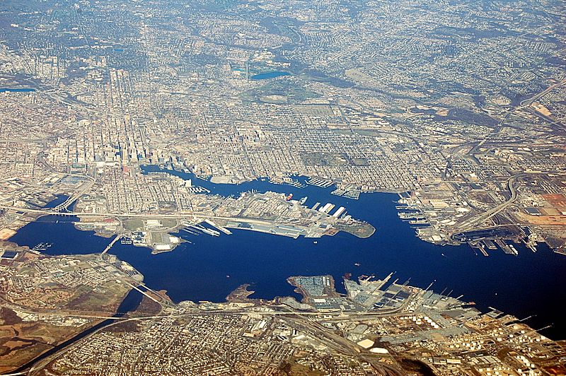
Description: An aerial view of Baltimore, Maryland, looking north. At left, one can see two stadiums just southwest of the downtown highrises. The top one is Camden Yards, home of the Baltimore Orioles and the bottom one is M&T Bank Stadium, home of the Ravens. The large 'T' intersection between two highways below these is that of I-395 and I-95. I-95 travels east-west near the seaport and under the Fort McHenry Tunnel center-right and picks up on the other side.
Title: Baltimore Aerial
Credit: Own work
Author: Fletcher6
Usage Terms: Creative Commons Attribution-Share Alike 3.0
License: CC BY-SA 3.0
License Link: https://creativecommons.org/licenses/by-sa/3.0
Attribution Required?: Yes
Image usage
The following page links to this image:

All content from Kiddle encyclopedia articles (including the article images and facts) can be freely used under Attribution-ShareAlike license, unless stated otherwise.