
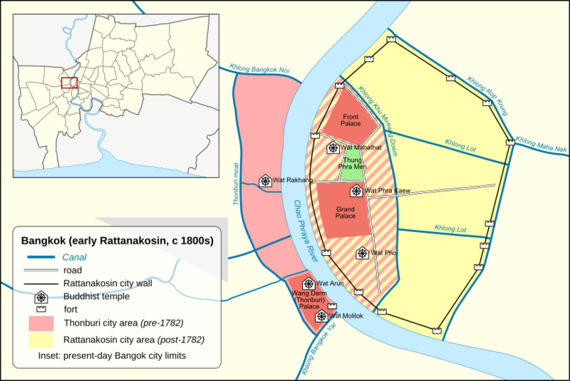
Image: Bangkok (early Rattanakosin) map

Size of this PNG preview of this SVG file: 800 × 535 pixels. Other resolution: 320 × 214 pixels.
Original image (SVG file, nominally 864 × 578 pixels, file size: 604 KB)
Description: Map of Bangkok in the early Rattanakosin period
Title: Bangkok (early Rattanakosin) map
Credit: Own work, based on OpenStreetMap export (CC-BY-SA 2.0), File:Thailand Bangkok location map.svg (CC-BY-SA 3.0) and 2020_stBN_placeofworship_buddhist.svg from the OpenStreetMap Wiki (CC-BY-SA 2.0)
Author: Paul_012, based on works by: OpenStreetMap contributors User:Hdamm (Thailand Bangkok location map.svg) Sergionaranja (2020_stBN_placeofworship_buddhist.svg)
Usage Terms: Creative Commons Attribution-Share Alike 3.0
License: CC BY-SA 3.0
License Link: https://creativecommons.org/licenses/by-sa/3.0
Attribution Required?: Yes
Image usage
The following page links to this image:

All content from Kiddle encyclopedia articles (including the article images and facts) can be freely used under Attribution-ShareAlike license, unless stated otherwise.
_map.svg)