
Image: Barking Barrier - geograph.org.uk - 321573
No higher resolution available.
Barking_Barrier_-_geograph.org.uk_-_321573.jpg (640 × 480 pixels, file size: 81 KB, MIME type: image/jpeg)
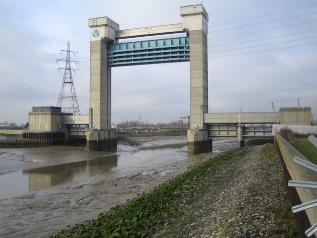
Description: Barking Barrier This is the downstream side of the barrier, which was built over a period of four years, being completed in 1983. It is about 60 metres high, and was needed to be this size to allow shipping to reach the Town Quay in Barking further upstream. The barrier crosses the Barking Creek reach of the River Roding, at its confluence with the River Thames.
Title: Barking Barrier - geograph.org.uk - 321573
Credit: From geograph.org.uk
Author: Nigel Cox
Usage Terms: Creative Commons Attribution-Share Alike 2.0
License: CC BY-SA 2.0
License Link: https://creativecommons.org/licenses/by-sa/2.0
Attribution Required?: Yes
Image usage
The following page links to this image:

All content from Kiddle encyclopedia articles (including the article images and facts) can be freely used under Attribution-ShareAlike license, unless stated otherwise.