
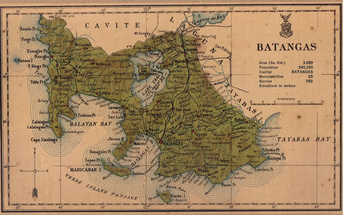
Image: Batangas province 1918 map
No higher resolution available.
Batangas_province_1918_map.JPG (700 × 439 pixels, file size: 111 KB, MIME type: image/jpeg)
Description: Map of Batangas Province, Philippines in 1918
Title: Batangas province 1918 map
Credit: Census of the Philippine Islands (1918)
Author: Census Office of the Philippine Islands
Usage Terms: Public domain
License: Public domain
Attribution Required?: No
Image usage
The following 2 pages link to this image:

All content from Kiddle encyclopedia articles (including the article images and facts) can be freely used under Attribution-ShareAlike license, unless stated otherwise.