
Image: Battle of Hendersons Hill Map
Size of this preview: 675 × 600 pixels. Other resolutions: 270 × 240 pixels | 763 × 678 pixels.
Original image (763 × 678 pixels, file size: 338 KB, MIME type: image/jpeg)
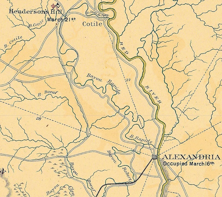
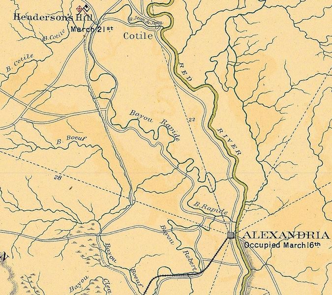
Description: Map shows where the Battle of Henderson's Hill was fought in relation to Alexandria, Louisiana. It is taken from a map prepared by the USA War Dept. in January 1865.
Title: Battle of Hendersons Hill Map
Credit: https://upload.wikimedia.org/wikipedia/commons/e/e9/RED_RIVER_CAMPAIGN_MAP_9802_x_5926.jpg
Author: Colonel John S. Clark, Engineer Bureau, War Department. January 1865.
Usage Terms: Public domain
License: Public domain
Attribution Required?: No
Image usage
The following page links to this image:

All content from Kiddle encyclopedia articles (including the article images and facts) can be freely used under Attribution-ShareAlike license, unless stated otherwise.