
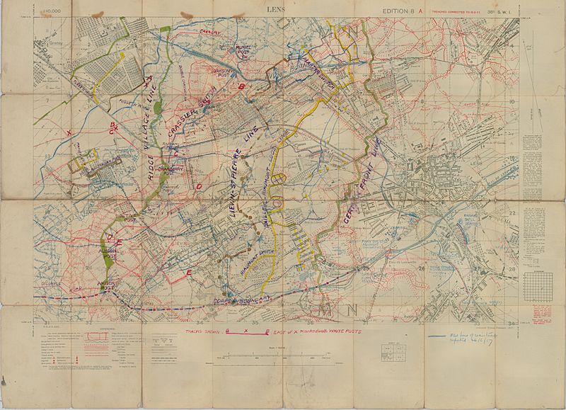
Image: Battle of Hill 70 - local planning map

Description: High Resolution Local Planning Map [1:10,000]. Light linen backing. Trenches corrected to 10-02-17. Disclaimer regardig obstacles, water features in blue.Contours and water features show in colour. Extensive amount of annotation regarding roads, railways, defensive lines, boundaries, locations of defensive positions, new construction and destroyed bridges. Sheet numbers: 36c SW1
Title: Battle of Hill 70 - local planning map
Credit: McMaster University, Fonds: WW1 Trench Maps: France, Box no. 6, envelope no. 188, database no. 123 Online: http://lt1.mcmaster.ca/ww1/wrz4mp.php?grid=57c&map_id=123
Author: Field Service Battalion, Royal Engineers
Permission: Public domain works must be out of copyright in both the United States and in the source country of the work in order to be hosted on the Commons. If the work is not a U.S. work, the file must have an additional copyright tag indicating the copyright status in the source country. Note: This tag should not be used for sound recordings.PD-1923Public domain in the United States//commons.wikimedia.org/wiki/File:Battle_of_Hill_70_-_local_planning_map.jpg
Usage Terms: Public domain
License: Public domain
Attribution Required?: No
Image usage
The following page links to this image:
