
Image: Battle of the Wilderness May 5 Orange Turnpike
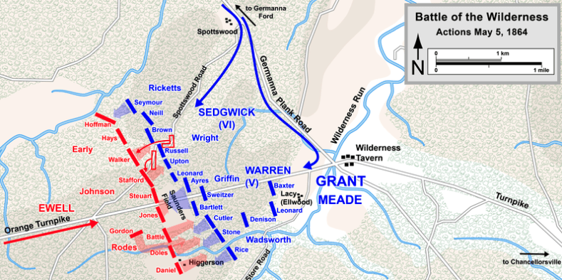
Description: Map shows Confederate (red) and Union (blue) troop positions near the Orange Turnpike on May 5, 1864, in the Battle of the Wilderness that was part of the American Civil War.
Title: Battle of the Wilderness May 5 Orange Turnpike
Credit: A Wikimedia Commons file named Wilderness May5.png that has been modified by TwoScarsUp. The modification is simply a crop eliminating the bottom half of the file so that the viewer focuses only on the Orange Turnpike (northern) portion of the battle. Map compares favorably with chapter 4 (beginning on page 145) of The Battle of the Wilderness May 5-6, 1864, by Gordon C. Rhea. The original author is User:Hlj, and the crop was by TwoScarsUp. The original was drawn in Adobe Illustrator CS5 by Hal Jespersen. Graphic source file is available at http://www.posix.com/CWmaps/
Author: The original author is User:Hlj (Hal Jespersen), and the crop was by TwoScarsUp
Usage Terms: Creative Commons Attribution 3.0
License: CC BY 3.0
License Link: https://creativecommons.org/licenses/by/3.0
Attribution Required?: Yes
Image usage
The following page links to this image:
