
Image: BayOfMaine1713

Size of this preview: 800 × 567 pixels. Other resolutions: 320 × 227 pixels | 2,761 × 1,958 pixels.
Original image (2,761 × 1,958 pixels, file size: 2.23 MB, MIME type: image/jpeg)
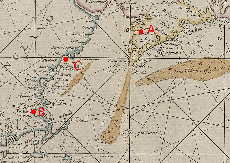
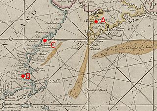
Description: Detail from a 1713 map showing the Gulf of Maine and the Bay of Fundy, an area that saw conflict in the War of the Spanish Succession. Map is annotated as follows: A: Port Royal, Acadia B: Boston, Province of Massachusetts Bay C: Casco Bay
Title: BayOfMaine1713
Credit: Boston Public Library digital map collection, Call Number: G3320 1713 .T56: http://maps.bpl.org/details_10062/
Author: John Thornton; annotations by User:Magicpiano
Usage Terms: Public domain
License: Public domain
Attribution Required?: No
Image usage
The following 2 pages link to this image:

All content from Kiddle encyclopedia articles (including the article images and facts) can be freely used under Attribution-ShareAlike license, unless stated otherwise.