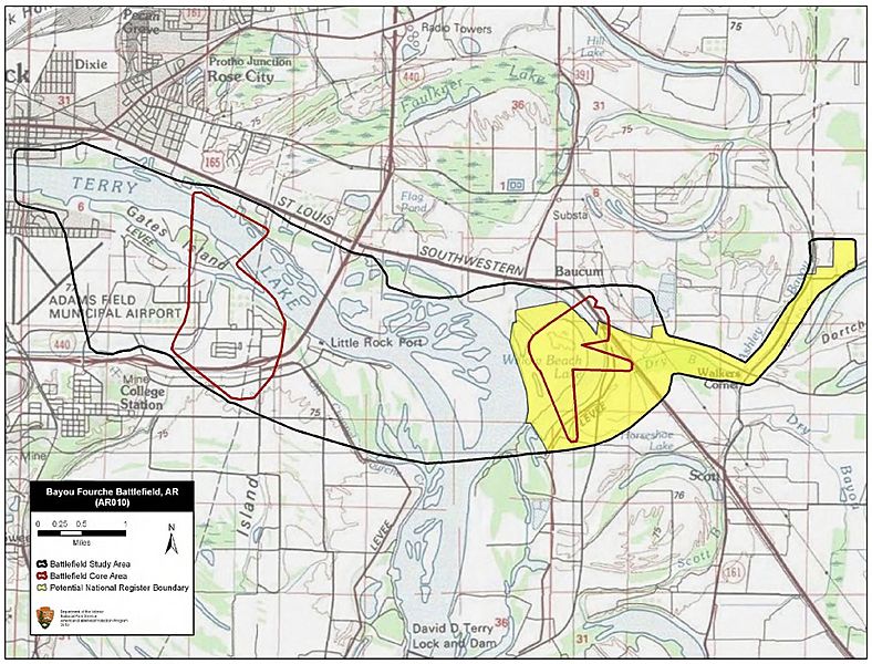
Image: Bayou Fourche Battlefield Arkansas

Description: Map of battlefield core and study areas. The ABPP extended the Study Area to include the approach route of the Federal infantry along the northern edge of the Arkansas River, the Federal route of advance from Ashley's Mills to the city of Little Rock, and the camps from which the Confederates moved to dig their defensive positions. The Core Area was reduced and cut into two areas. The eastern Core Area represents the artillery duel and skirmishing that preceded the Federal crossing of the Arkansas River. The western Core Area represents the location of action against the Confederate defensive line along Bayou Fourche, including Federal artillery positions north of the Arkansas River that fired upon the Confederate line.
Title: Bayou Fourche Battlefield Arkansas
Credit: National Park Service
Author: American Battlefield Protection Program
Usage Terms: Public domain
License: Public domain
Attribution Required?: No
Image usage
The following page links to this image:

