
Image: Berkeleyblue Jeffersonred
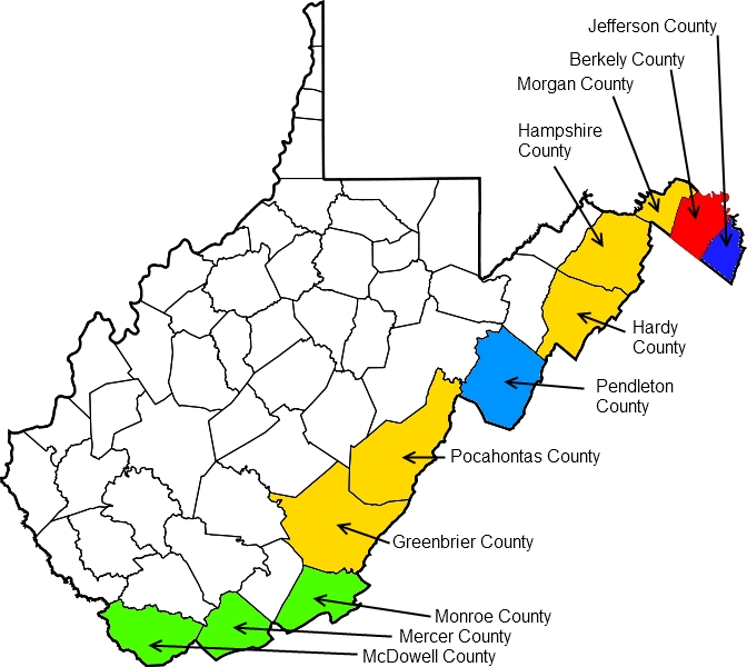
Description: Map of the development of West Virginia covering the period June 19, 1861, to March 6, 1871. Counties in white are the original counties whose delegates authorized secession from the state of Virginia on August 6, 1861, at the Second Wheeling Convention. Berkeley County (red), Jefferson County (dark blue), and the counties marked in yellow were also authorized at this time to secede if their voters approved. Counties in green were added to the new state of West Virginia at the West Virginia constitutional convention, held November 26, 1861, to February 18, 1862. The county in light blue was offered the chance to join the new state during the constitutional convention if its voters approved. A legal dispute over the elections through which Berkeley and Jefferson counties seceded from Virginia was not resolved until the U.S. Supreme Court's decision in Virginia v. West Virginia, 78 U.S. 39 (1871).
Title: Berkeleyblue Jeffersonred
Credit: Own work
Author: Tim1965
Usage Terms: Creative Commons Attribution-Share Alike 3.0
License: CC BY-SA 3.0
License Link: https://creativecommons.org/licenses/by-sa/3.0
Attribution Required?: Yes
Image usage
The following page links to this image:
