
Image: Bermuda Hundred Campaign topography

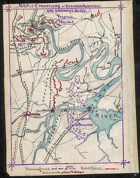
Description: Bermuda Hundred (Virginia) Campaign. The map shows several engagements that took place between Butler's Army of the James and Beauregard's Confederates, May 6th through May 13th, 1864. Includes Port Walthall Junction, Confederate defense of Fort Darling at Drewry's Bluff, Union entrenchments at Bermuda Hundred and City Point. Color coding indicates the location of Union and Confederate forces and fortifications.
Title: Bermuda Hundred Campaign topography
Credit: Collections of the Virginia Historical Society - Library of Congress
Author: Robert Knox Sneden
Permission: This image is a work of a U.S. military or Department of Defense employee, taken or made as part of that person's official duties. As a work of the U.S. federal government, the image is in the public domain in the United States.
Usage Terms: Public domain
License: Public domain
Attribution Required?: No
Image usage
The following page links to this image:
