
Image: Bermuda topographic map-en
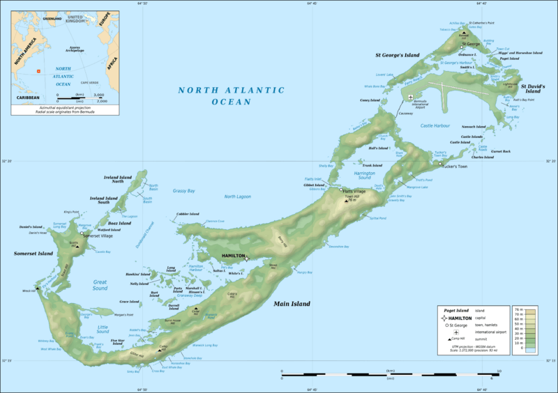
Description: Topographic map of Bermuda Islands, Great Britain, in the North Atlantic Ocean. Note: The background map is a raster image embedded in the SVG file.
Title: Bermuda topographic map-en
Credit: Own work ; Sources of data: Topography: NASA Shuttle Radar Topography Mission (SRTM30) (public domain); Shorelines: created from Landsat ETM+ imagery (public domain); Locator map: NGDC World Coast Line (public domain); Additional references used: Names: Bermudatourism's map.
Author: Eric Gaba (Sting - fr:Sting)
Permission: Attribution and Share-Alike required Any use of this map can be made as long as you credit me (Eric Gaba – Wikimedia Commons user: Sting) as the author and distribute the copies and derivative works under the same license(s) that the one(s) stated below. A message with a reply address would also be greatly appreciated.
Usage Terms: GNU Free Documentation License
License: GFDL
License Link: http://www.gnu.org/copyleft/fdl.html
Attribution Required?: Yes
Image usage
There are no pages that link to this image.
