
Image: Birch Islands Maine (USGS 1904)
Size of this preview: 526 × 599 pixels. Other resolutions: 211 × 240 pixels | 603 × 687 pixels.
Original image (603 × 687 pixels, file size: 167 KB, MIME type: image/jpeg)
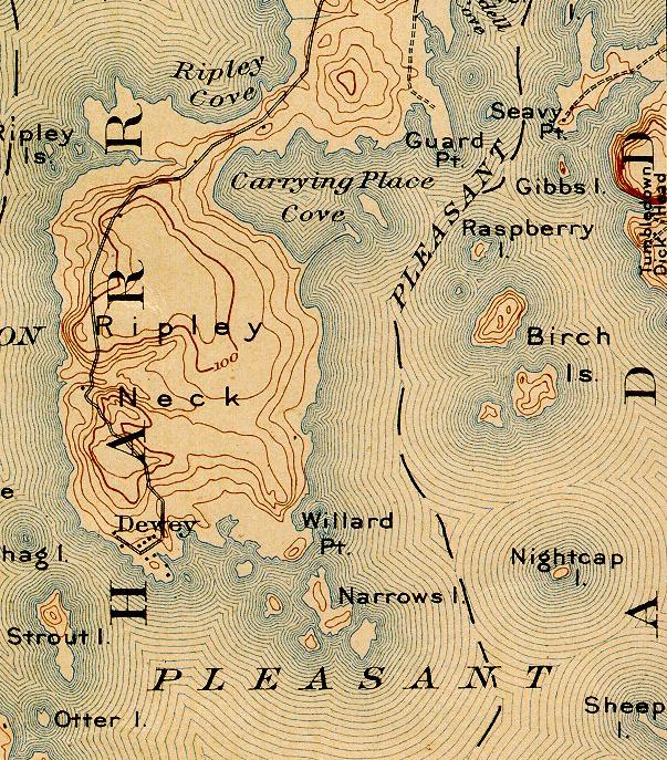
Description: Excerpt of Cherryfield, ME Quadrangle USGS 1904 map, southeast corner, showing Birch Islands in Pleasant Bay, Maine
Title: Birch Islands Maine (USGS 1904)
Credit: http://docs.unh.edu/nhtopos/Cherryfield.htm
Author: USGS
Permission: US Government work, 1904
Usage Terms: Public domain
License: Public domain
Attribution Required?: No
Image usage
The following page links to this image:

All content from Kiddle encyclopedia articles (including the article images and facts) can be freely used under Attribution-ShareAlike license, unless stated otherwise.
.jpg)