
Image: Bird's Eye View of the Life of Christ
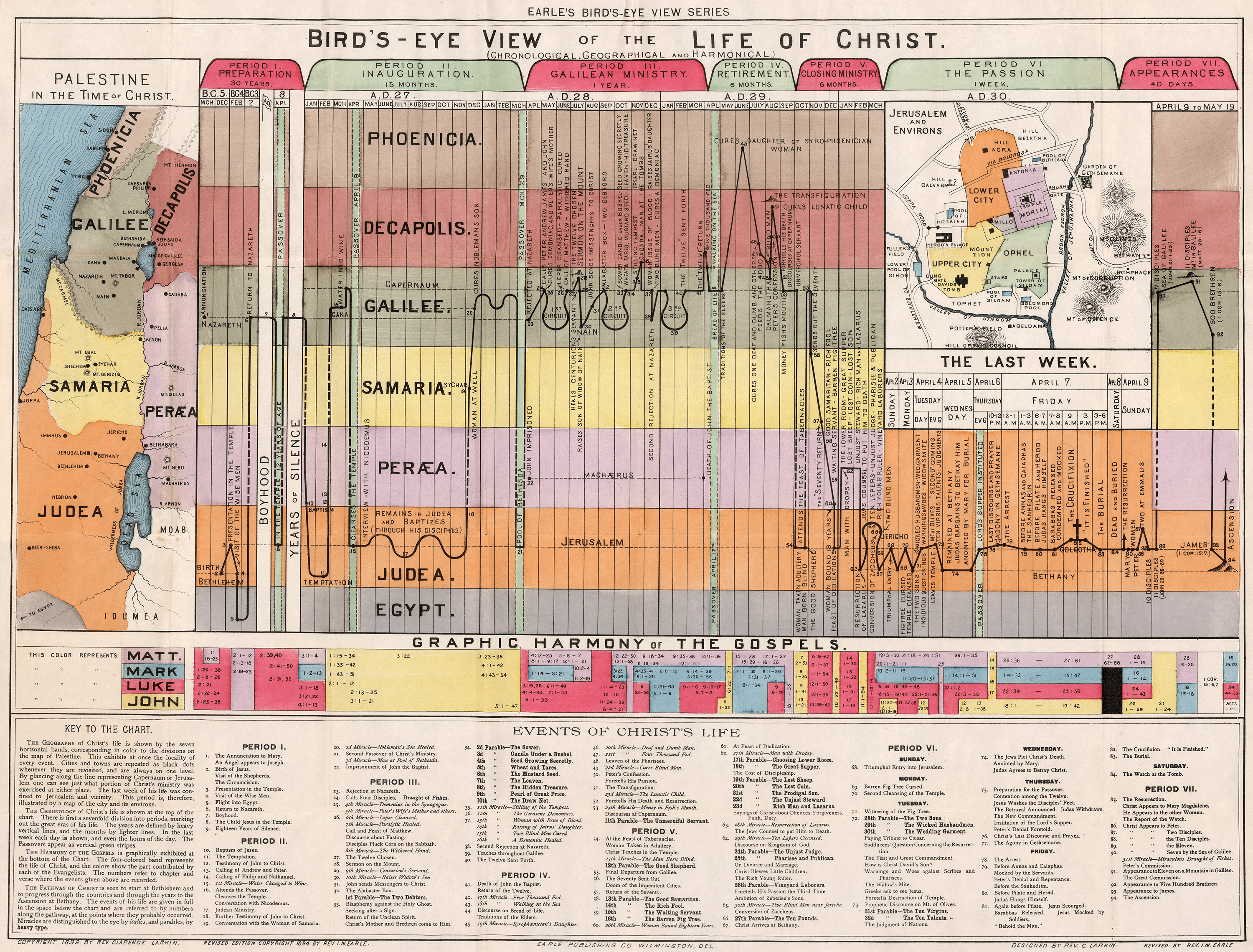
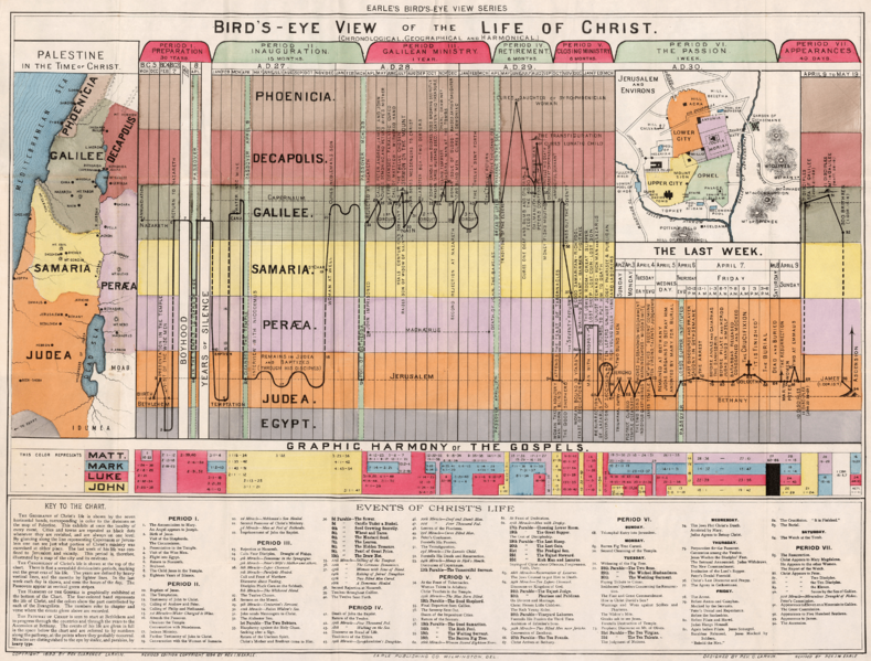
Description: The Geography of Christ's life is shown by the seven horizontal bands, corresponding in color to the divisions on the map of Palestine. This exhibits at once the locality of every event. Cities and towns are repeated as black dots whenever they are revisited, and are always on one level. By glancing along the line representing Capernaum or Jerusalem one can see just what portion of Christ's ministry was exercised at either place. The last week of his life was confined to Jerusalem and vicinity. This period is, therefore, illustrated by a map of the city and its environs. The Chronology of Christ's life is shown at the top of the chart. There is first a sevenfold division into periods, marking out the great eras of his life. The years are defined by heavy vertical lines, and the months by lighter lines. In the last week each day is shown, and even the hours of the day. The Passovers appear as vertical green stripes. The Harmony of the Gospels is graphically exhibited at the bottom of the Chart. The four-colored band represents the life of Christ, and the colors show the part contributed by each of the Evangelists. The numbers refer to chapter and verse where the events given above are recorded. The Pathway of Christ is seen to start at Bethlehem and to progress through the countries and through the years to the Ascension at Bethany. The events of his life are given in full in the space below the chart and are referred to by numbers along the pathway, at the points where they probably occurred. Miracles are distinguished to the eye by italics, and parables, by heavy type.
Title: Bird's Eye View of the Life of Christ
Credit: UsefulCharts
Author: Rev. I. N. Earle
Usage Terms: Public domain
License: Public domain
Attribution Required?: No
Image usage
The following page links to this image:
