
Image: Black Creek satellite map
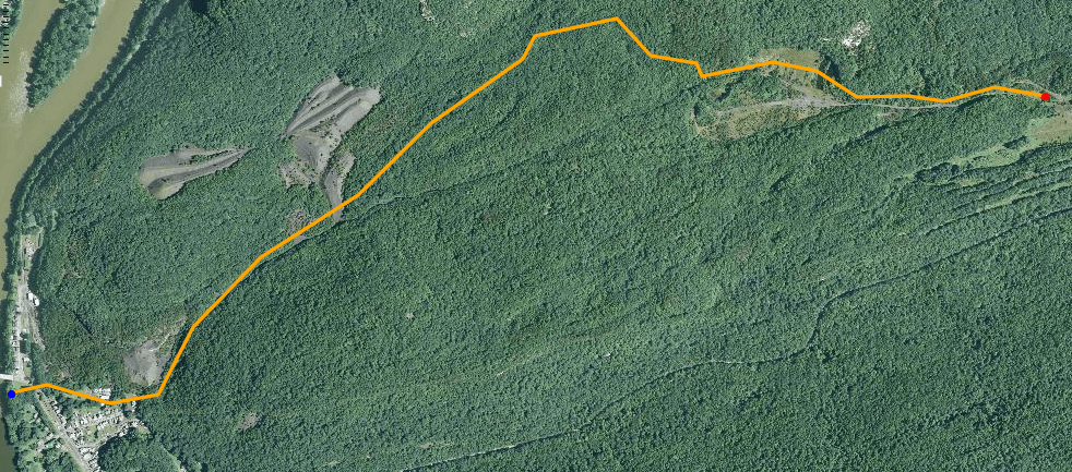
Description: Satellite map of Black Creek, the second and northernmost left bank tributary of the Susquehanna River named Black Creek in Luzerne County, Pennsylvania, in the United States.[1] The red dot is the source and the blue dot is the mouth. It is approximately 2.6 miles (4.2 km) long and flows through Conyngham Township. The other Black Creek (Nescopeck Creek} is also a left bank tributary of the Susquehanna River via Nescopeck Creek entering the river in Nescopeck, PA, a Pennsylvania borough (town) in Luzerne County, Pennsylvania. Black Creek was entered into the Geographic Names Information System on August 2, 1979. Its identifier in the Geographic Names Information System is 1169696.[1] The elevation near the mouth of Black Creek is 482 feet (147 m) above sea level.[1] Data available from U.S. Geological Survey, National Geospatial Program. According to the National Map Viewer (Topographic mode), by inspection: the elevation of the creek's source is between 840 and 860 feet (260 and 260 m) above sea level. The lowest elevations in the watershed are approximately 500 feet (150 m) above sea level and they occur near the Susquehanna River.
Title: Black Creek satellite map
Credit: http://viewer.nationalmap.gov/viewer/
Author: United States Geological Survey
Usage Terms: Public domain
License: Public domain
Attribution Required?: No
Image usage
The following page links to this image:
