
Image: BlueLine
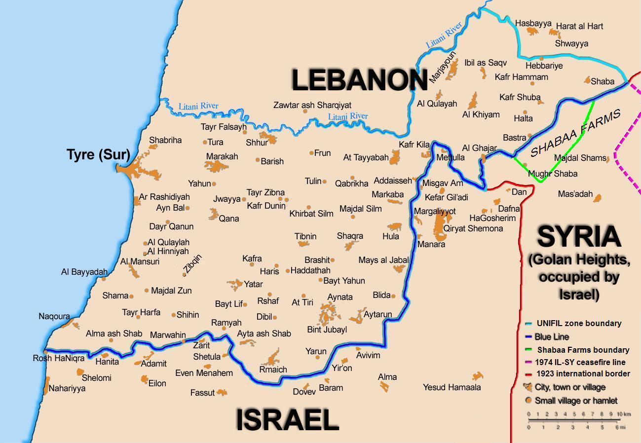
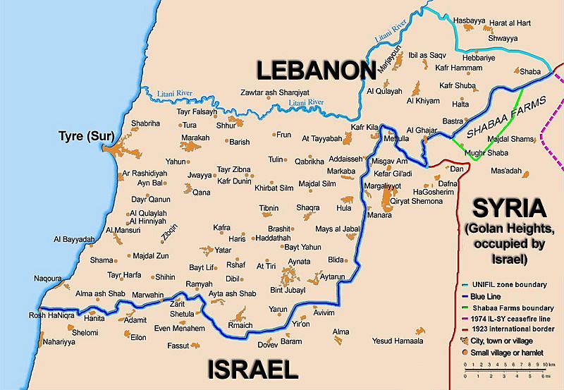
Description: Map showing the Blue Line demarcation line between Lebanon and Israel, established by the UN after the Israeli withdrawal from southern Lebanon after its short 1978 invasion called Operation Litani. It follows the 1949 cease-fire line, also known as the Green Line, as well as the somewhat contested Lebanese-Syrian border towards the Israeli-occupied Golan Heights.
Title: BlueLine
Credit: Self-published work by 99of9
Author: 99of9 / * The map is made by Thomas Blomberg using the UNIFIL map, deployment as of July 2006 as source.
Usage Terms: Creative Commons Attribution-Share Alike 2.5
License: CC BY-SA 2.5
License Link: http://creativecommons.org/licenses/by-sa/2.5
Attribution Required?: Yes
Image usage
The following 4 pages link to this image:
