
Image: Bombaymapconfimed attacks
Size of this preview: 577 × 600 pixels. Other resolutions: 231 × 240 pixels | 905 × 941 pixels.
Original image (905 × 941 pixels, file size: 222 KB, MIME type: image/png)
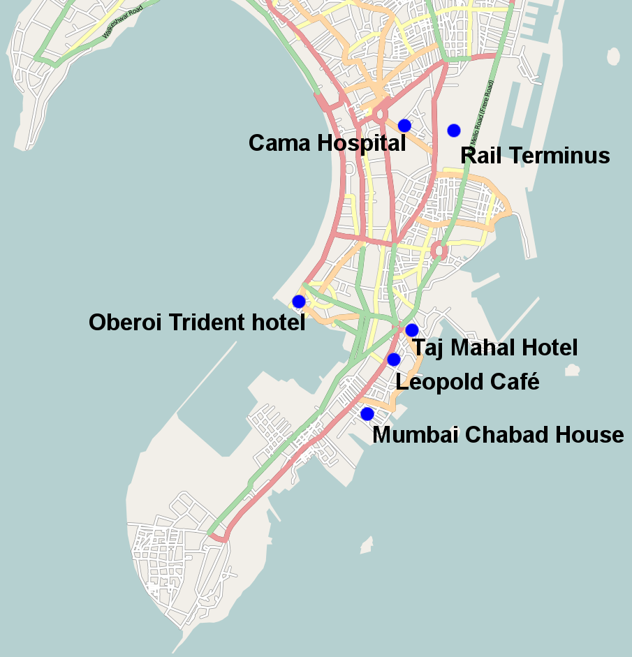
Description: Map of the fairly solidly confimed locations of the 26 November 2008 Mumbai attacks except Vile Parle suburb which is too vague and the port attack which again is still unclear also missing is the police station where it is unclear which one came under attack
Title: Bombaymapconfimed attacks
Credit: open streetmaps with modifications http://www.openstreetmap.org/?lat=19.0072&lon=72.865&zoom=12&layers=B000FTFT
Author: user:geni open street maps
Permission: Creative Commons Attribution-ShareAlike 2.0
Usage Terms: Creative Commons Attribution-Share Alike 2.0
License: CC BY-SA 2.0
License Link: http://creativecommons.org/licenses/by-sa/2.0
Attribution Required?: Yes
Image usage
The following page links to this image:

All content from Kiddle encyclopedia articles (including the article images and facts) can be freely used under Attribution-ShareAlike license, unless stated otherwise.