
Image: Booth map of Whitechapel
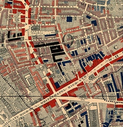
Description: Map of Whitechapel from Charles Booth's Labour and Life of the People. Volume 1: East London (London: Macmillan, 1889). The streets are coloured to represent the economic class of the residents: Yellow ("Upper-middle and Upper classes, Wealthy"), red ("Lower middle class - Well-to-do middle class"), pink ("Fairly comfortable good ordinary earnings"), blue ("Intermittent or casual earnings"), and black ("lowest class...occasional labourers, street sellers, loafers, criminals and semi-criminals")
Title: Booth map of Whitechapel
Credit: http://www.umich.edu/~risotto/maxzooms/ne/nej56.html (cropped). Original: Charles Booth's Labour and Life of the People. Volume 1: East London (London: Macmillan, 1889).
Author: Charles Booth
Permission: This image is in the public domain in the United States because it was first published outside of the United States before 1923
Usage Terms: Public domain
License: Public domain
Attribution Required?: No
Image usage
The following 4 pages link to this image:
