
Image: Borneo Locator Topography

Size of this preview: 553 × 599 pixels. Other resolutions: 221 × 240 pixels | 1,605 × 1,739 pixels.
Original image (1,605 × 1,739 pixels, file size: 2.61 MB, MIME type: image/png)
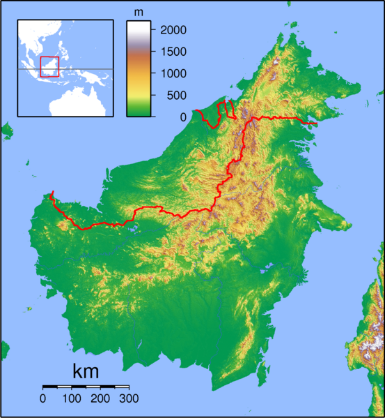
Description: Topographic locator map of Borneo. Created with GMT from public domain SRTM data. For non-locator version, see Image:Borneo Topography.png. Left:108 Bottom:-5 Right:120 Top:8
Title: Borneo Locator Topography
Credit: Own work
Author: Sadalmelik
Usage Terms: Creative Commons Attribution-Share Alike 3.0
License: CC BY-SA 3.0
License Link: https://creativecommons.org/licenses/by-sa/3.0
Attribution Required?: Yes
Image usage
The following page links to this image:

All content from Kiddle encyclopedia articles (including the article images and facts) can be freely used under Attribution-ShareAlike license, unless stated otherwise.