
Image: Bostmtnterrain
No higher resolution available.
Bostmtnterrain.jpg (800 × 406 pixels, file size: 307 KB, MIME type: image/jpeg)
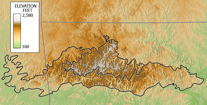
Description: Elevation map of the Boston Mountains of Arkansas and Oklahoma based on Shuttle Radar Topography Mission (SRTM) 3 arcsecond digitial elevation model data.
Title: Bostmtnterrain
Credit: Own work
Author: Tosborn (talk) (Uploads)
Usage Terms: Public domain
License: PD
Attribution Required?: No
Image usage
There are no pages that link to this image.

All content from Kiddle encyclopedia articles (including the article images and facts) can be freely used under Attribution-ShareAlike license, unless stated otherwise.