
Image: Boston-Mines-1945
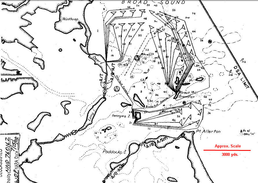
Description: This map of the controlled mine fields protecting Boston Harbor in 1945 comes from the report "Supplement to the Harbor Defense Project: Harbor Defenses of Boston," U.S. Army Engineers, 31 January, 1945. It shows 30 Groups of mines (the triangular symbols at the ends of the connecting cables), nominally of 19 mines per group, controlled (variously) from Ft. Dawes on Deer Island, Ft. Warren on Georges Island, and from Great Brewster Island. The map also indicates the boom and netting barriers that guarded the inner harbor by closing the channel between Long Island and Deer Island, the gap between Long Island and Moon Island, and the channels on either end of Peddocks Island. This image is an enlargement of a portion of the original map, which has been sharpened and had an approximate scale (in red) added for use on Wikipedia.
Title: Boston-Mines-1945
Credit: see above
Author: US gov
Usage Terms: Public domain
License: Public domain
Attribution Required?: No
Image usage
The following 3 pages link to this image:
