
Image: Boteti River, Botswana
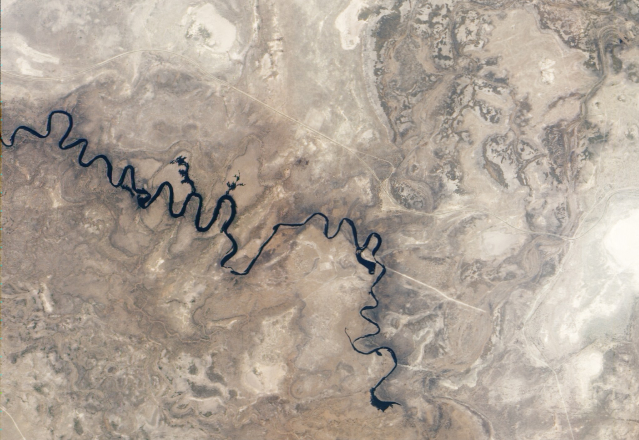
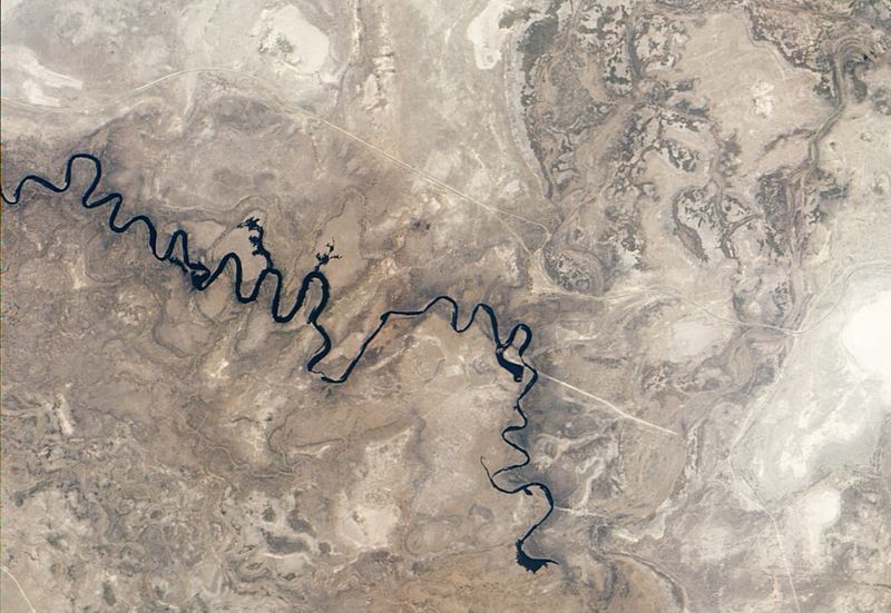
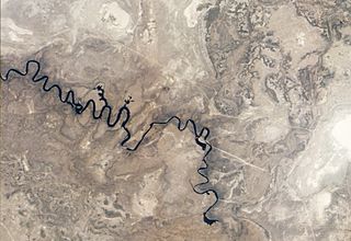
Description: Natural-colour image of the Boteti River. Arising from overflow in the Okavango Delta, the Boteti River flows toward the south-east before turning northward into the expansive salt-pans of Makgadikgadi. This image shows the river stopping short of Makgadikgadi, which lies to the east. The river follows a long series of hairpin curves. On the outer loops of some curves, the river overflows onto nearby floodplains. Two such overflows are obvious near the centre of the image. In the east, another area of overflow takes the approximate shape of a boot. Here the water has probably flowed onto agricultural fields, and the water’s spread may be constrained by a nearby road. Near the lower right corner of the image, the Boteti River terminates. Upstream from this endpoint, the river is particularly thin. The water supply may still be insufficient to drive the Boteti onward into the nearby saltpans. According to Frank Eckhardt of the University of Cape Town, the presence of any water in the river valley was unusual by 2010, and some observers thought the Boteti was a dead river. Naturalist blogs reported that the Boteti held some water in September 2009, but according to Eckardt, its last major flood occurred in 1991. Outside of the river valley, the dry season has parched the landscape. Nearby river valleys, floodplains, and salt lakes appear in tones of beige and brown.
Title: Boteti River, Botswana
Credit: NASA Earth Observatory Image captured by the Advanced Land Imager (ALI) on NASA’s Earth Observing-1 (EO-1) satellite. EO-1 ALI data provided courtesy of the NASA EO-1 team and the United States Geological Survey.
Author: Jesse Allen and Robert Simmon
Usage Terms: Public domain
License: Public domain
Attribution Required?: No
Image usage
The following page links to this image:
