
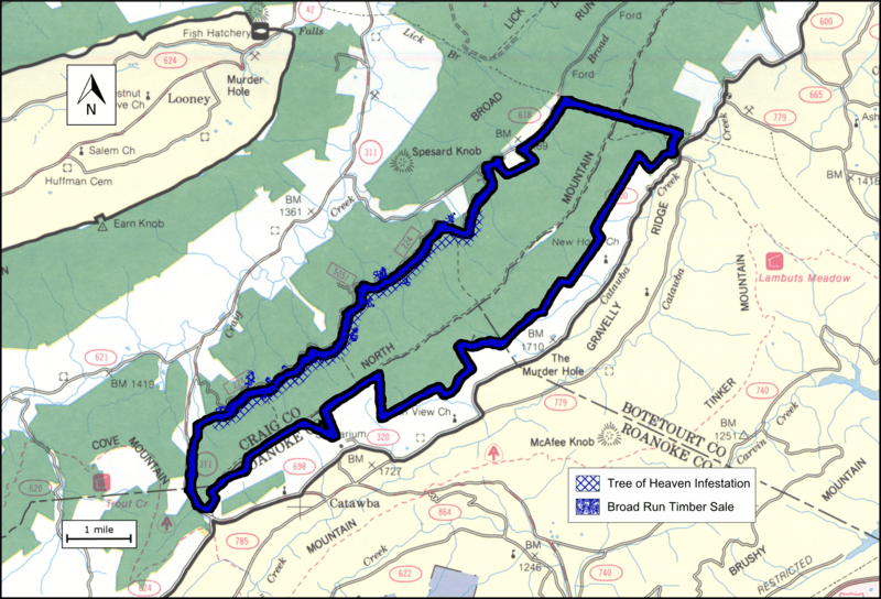
Image: Boundary of the North Mountain wildland as identified by the Wilderness Society

Size of this preview: 800 × 544 pixels. Other resolutions: 320 × 218 pixels | 2,033 × 1,382 pixels.
Original image (2,033 × 1,382 pixels, file size: 4.94 MB, MIME type: image/png)
Description: Boundary of the North Mountain wildland as identified by the Wilderness Society
Title: Boundary of the North Mountain wildland as identified by the Wilderness Society
Credit: the file was created by drawing a boundary on a scanned image of the Forest Service map "Jefferson National Forest (North Half), Virginia, 1983, Recreation Guide R8-RG 167, reprinted June 1997”. A jpg file of the scanned image is 1983 Map of the north portion of the Jefferson National Forest in southwest Virginia
Author: US Forest Service
Usage Terms: Public domain
License: Public domain
Attribution Required?: No
Image usage
The following page links to this image:

All content from Kiddle encyclopedia articles (including the article images and facts) can be freely used under Attribution-ShareAlike license, unless stated otherwise.