
Image: BristolCastle 1882Map

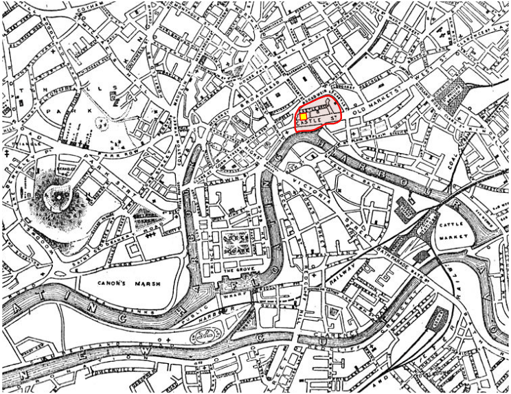
Description: Location of Bristol Castle overlaid on a map of Bristol in 1882 (File:Map of Bristol 1882.jpg) from Bristol Past and Present, vol. 3. Based on image of Casle boundaries in published as Bristol Castle in ancient times" from Samuel Seyer's History of Bristol, 1882, JF Nicholls and John Taylor, Bristol Past and Present. Yellow square shows Keep, of which remnants survive. Red line shows curtain wall, covering are of the former Castle Street, Castle Green and Castle Hill Sreet, as shown on the 1882 map. The area today covers most of the eastern part of "Castle Park", a greenspace recreation area. The surviving St Peter's Church, marked by a cross to the immediate west of the castle, provides a reliable landmark in identifying the site of the Castle. The entrance of the channel from the River Avon forming the former moat of the castle is still visible today.
Title: BristolCastle 1882Map
Credit: Samuel Seyer's History of Bristol, 1882, JF Nicholls and John Taylor,
Author: Unknown authorUnknown author
Usage Terms: Public domain
License: Public domain
Attribution Required?: No
Image usage
The following page links to this image:
