
Image: British Empire in the East, 1919
No higher resolution available.
British_Empire_in_the_East,_1919.png (580 × 301 pixels, file size: 8 KB, MIME type: image/png)
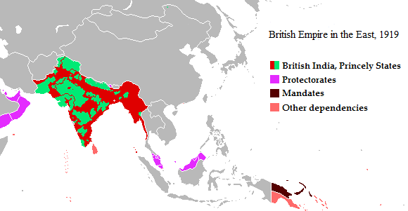
Description: Map of British Empire in the East, showing British India (red) and the princely states of India (green), British protectorates (purple) and dependencies (pink), and the Australian League of Nations mandate of New Guinea (black).
Title: British Empire in the East, 1919
Credit: adapted from File:BritishEmpire1919.png
Author: Moonraker and Maps & Lucy
Permission: public domain (see below)
Usage Terms: Creative Commons Attribution-Share Alike 2.5
License: CC BY-SA 2.5
License Link: https://creativecommons.org/licenses/by-sa/2.5
Attribution Required?: Yes
Image usage
The following page links to this image:

All content from Kiddle encyclopedia articles (including the article images and facts) can be freely used under Attribution-ShareAlike license, unless stated otherwise.