
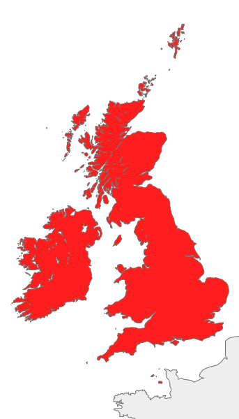
Image: British Isles all

Size of this PNG preview of this SVG file: 343 × 600 pixels. Other resolution: 137 × 240 pixels.
Original image (SVG file, nominally 675 × 1,180 pixels, file size: 54 KB)
Description: Map of Great Britain, Ireland, the Isle of Man and the Channel Islands, also known collectively as the British Isles, or the Islands of the North Atlantic
Title: British Isles all
Credit: Own work
Author: Cnbrb
Usage Terms: Public domain
License: Public domain
Attribution Required?: No
Image usage
There are no pages that link to this image.

All content from Kiddle encyclopedia articles (including the article images and facts) can be freely used under Attribution-ShareAlike license, unless stated otherwise.