
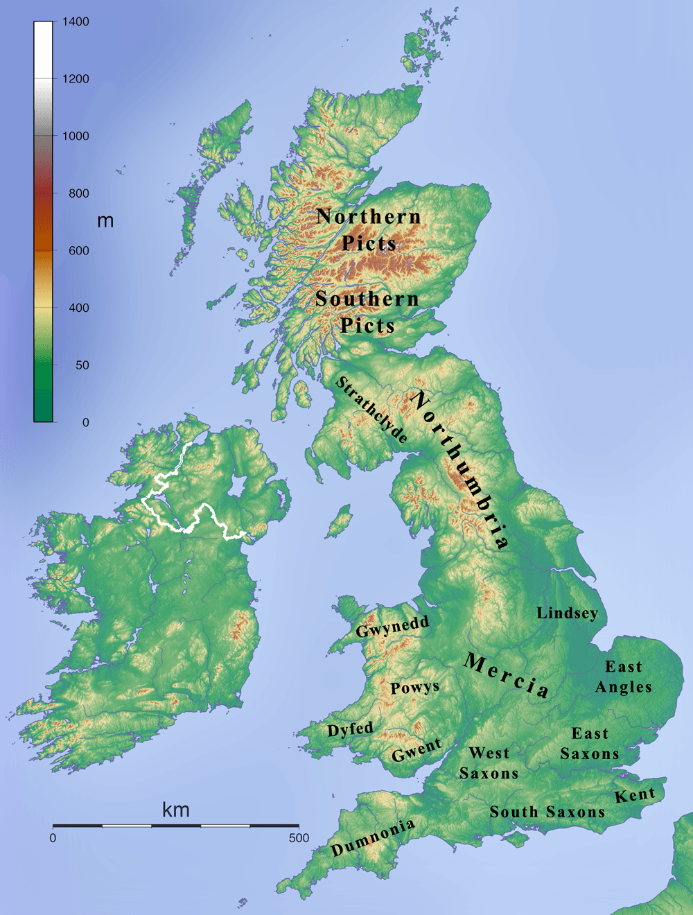
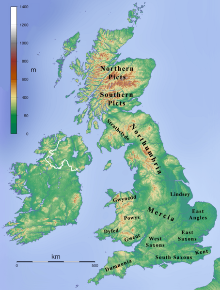
Image: British kingdoms c 800
Size of this preview: 454 × 599 pixels. Other resolutions: 182 × 240 pixels | 1,000 × 1,320 pixels.
Original image (1,000 × 1,320 pixels, file size: 469 KB, MIME type: image/png)
Description: Map depicting the British Isles during the 7th century.
Title: British kingdoms c 800
Credit: Own work created by combining File:Topographic Map of the UK - Blank.png and en:File:British 7C kingdoms with Bernicia and Deira.gif and removing the Bernicia and Deira labels.
Author: Kmusser
Usage Terms: Creative Commons Attribution-Share Alike 3.0
License: CC BY-SA 3.0
License Link: https://creativecommons.org/licenses/by-sa/3.0
Attribution Required?: Yes
Image usage
The following page links to this image:

All content from Kiddle encyclopedia articles (including the article images and facts) can be freely used under Attribution-ShareAlike license, unless stated otherwise.