
Image: Briton Ferry Road station site geograph-3269874-by-Ben-Brooksbank
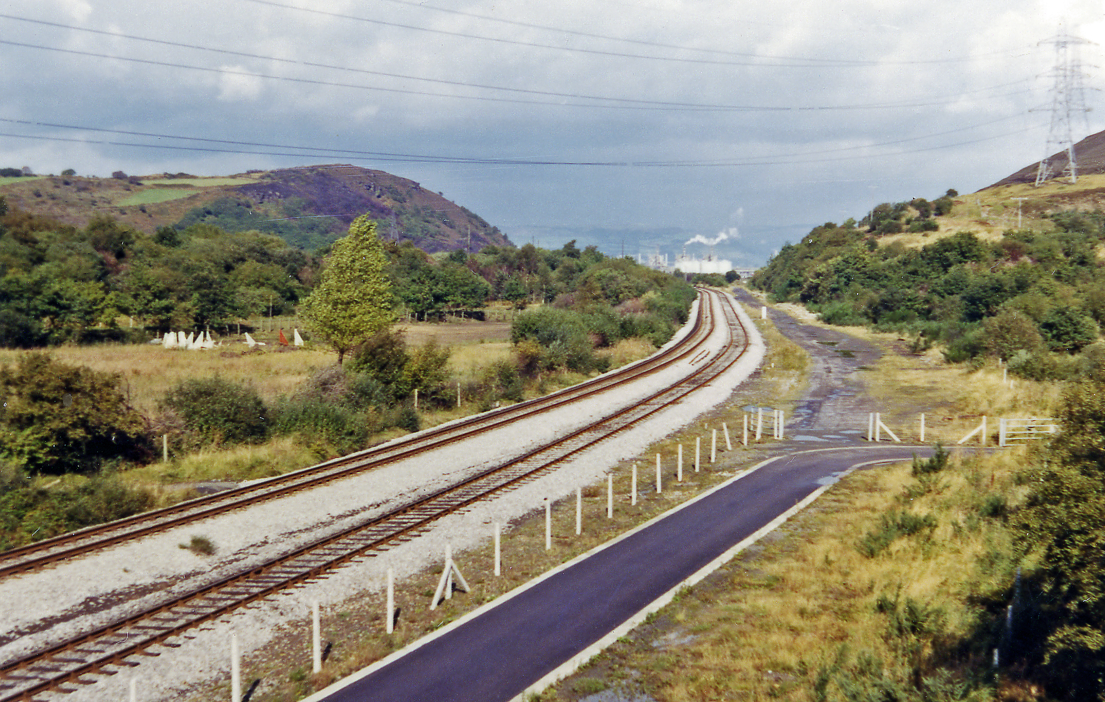
Description: Site of Briton Ferry Road station, 1973. View eastward from the B4290 bridge, towards Neath. The extant lines are those to Swansea Burrows Sidings and formerly Swansea East Dock, on which the station was situated until the passenger service from Neath (Low Level) operated until 28/9/36. On the nearer side, where the track has been lifted, there used to be Jersey Marine station (closed 11/9/33 to passengers) on the ex-Rhondda & Swansea Bay Railway from Swansea Dockside (later Danygraig) to Court Sart (and Neath), Aberavon and Cymmer to Treherbert, freight traffic on which continued along here until 12/67. Over on the left is the Tennant Canal and hidden by the hill is the vast Llandarcy Oil Refinery.
Title: Briton Ferry Road station site geograph-3269874-by-Ben-Brooksbank
Credit: From geograph.org.uk
Author: Ben Brooksbank
Permission: Creative Commons Attribution Share-alike license 2.0
Usage Terms: Creative Commons Attribution-Share Alike 2.0
License: CC BY-SA 2.0
License Link: https://creativecommons.org/licenses/by-sa/2.0
Attribution Required?: Yes
Image usage
The following page links to this image:
