
Image: Brumadinho dam catastrophy 2
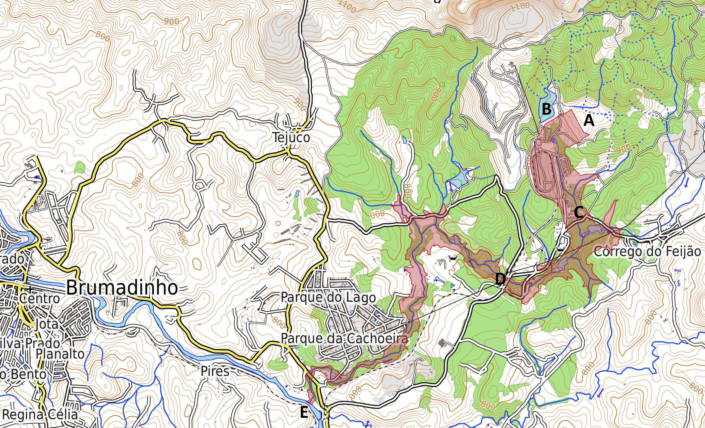
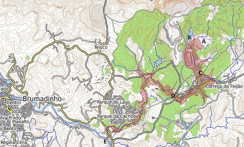
Description: Map of tailings dam collapse disaster east of Brumadinho at the Mina Córrego do Feijão. Highlighted in red is the coverage and destruction of the mine dump and debris after the collapse. A Location of destroyed dam and former tailings pond "Barragem I". B Location of second tailings pond "Barragem VI" with destabilized dam, due to the event. C Location of the destroyed office buildings and the cantina of the mine at Vila Ferteco. D Location of the destroyed railway bridge. E Location of the entry point of the mud flood into the river Rio Paraopeba.
Title: Brumadinho dam catastrophy 2
Credit: Map Dataː OpenStreetMap.org contributors. Map styleː OpenTopoMap.org [1] with SRTM data (Shuttle Radar Topography Mission). Shape of mud flow from dam collapseː Sentinel Satellite S2-L1C 2019-01-27 TCI/NDWI/NDVI at sentinel-hub.com via OpenStreetMap.org contributors layer [2]
Author: ESA / Copernicus Sentinel-2A-L1C Satellite and OpenStreetMap.org contributors
Usage Terms: Creative Commons Attribution-Share Alike 3.0-igo
License: CC BY-SA 3.0-igo
License Link: https://creativecommons.org/licenses/by-sa/3.0-igo
Attribution Required?: Yes
Image usage
The following page links to this image:
