
Image: C. 840 German Provinces
Size of this preview: 432 × 600 pixels. Other resolutions: 173 × 240 pixels | 933 × 1,295 pixels.
Original image (933 × 1,295 pixels, file size: 579 KB, MIME type: image/jpeg)
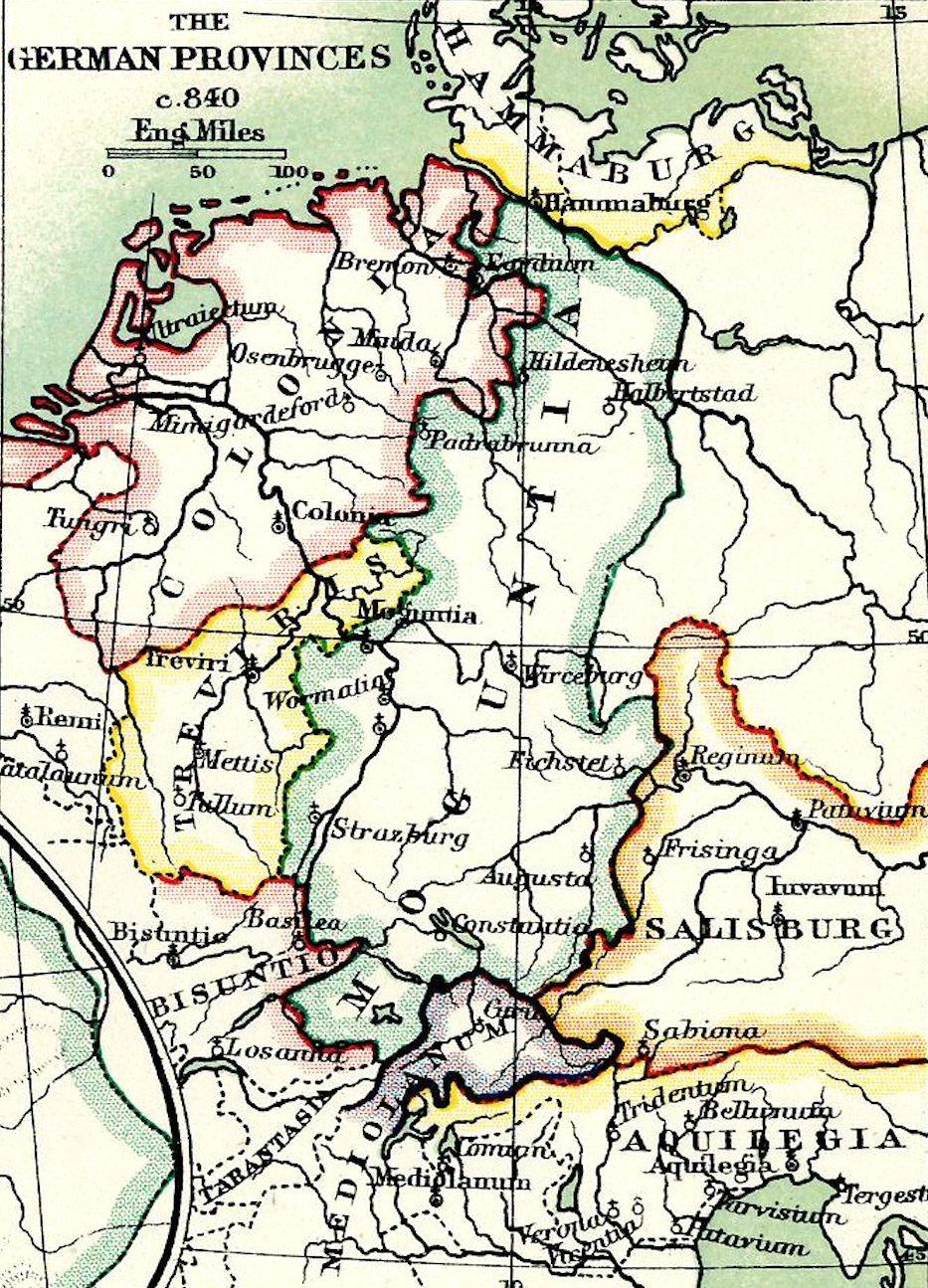
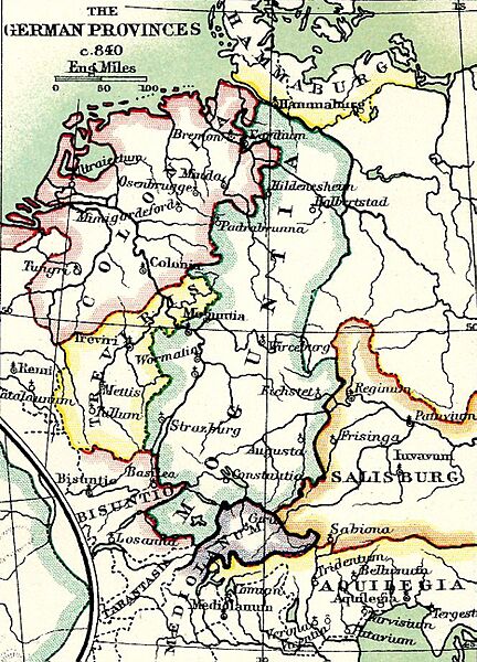
Description: Map of Germanic provinces circa 840 CE
Title: C. 840 German Provinces
Credit: Digitally-enhanced derivative of a public domain map by W. & A.K. Johnston (William Johnston (1802-1888), Lord Provost of Edinburgh, and Alexander Keith Johnston (1804-1871), Geographer-Royal for Scotland); maps published in Historical Atlas of Modern Europe from the Decline of the Roman Empire by Reginald Lane Poole (1857-1939), Keeper of the Archives, University of Oxford (published by Clarendon Press, London, Edinburgh and New York 1902); WorldCat: https://search.worldcat.org/title/189734
Author: W. & A. K. Johnston
Usage Terms: Public domain
License: Public domain
Attribution Required?: No
Image usage
The following page links to this image:

All content from Kiddle encyclopedia articles (including the article images and facts) can be freely used under Attribution-ShareAlike license, unless stated otherwise.