
Image: CDC map of Zika virus distribution as of 15 January 2016
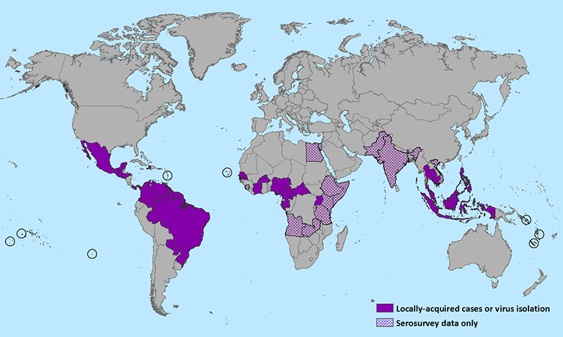
Description: Centers for Disease Control and Prevention map of the geographic distribution of Zika virus as of 15 January 2015
Title: CDC map of Zika virus distribution as of 15 January 2016
Credit: http://www.cdc.gov/zika/images/zik-world-map_01-15-2016_web.jpg
Author: United States Centers for Disease Control and Prevention
Permission: This image is a work of the Centers for Disease Control and Prevention, part of the United States Department of Health and Human Services, taken or made as part of an employee's official duties. As a work of the U.S. federal government, the image is in the public domain. čeština | Deutsch | English | español | eesti | suomi | français | italiano | македонски | Nederlands | polski | português | slovenščina | українська | 中文 | 中文(简体) | 中文(繁體) | +/−
Usage Terms: Public domain
License: Public domain
Attribution Required?: No
Image usage
The following page links to this image:
