
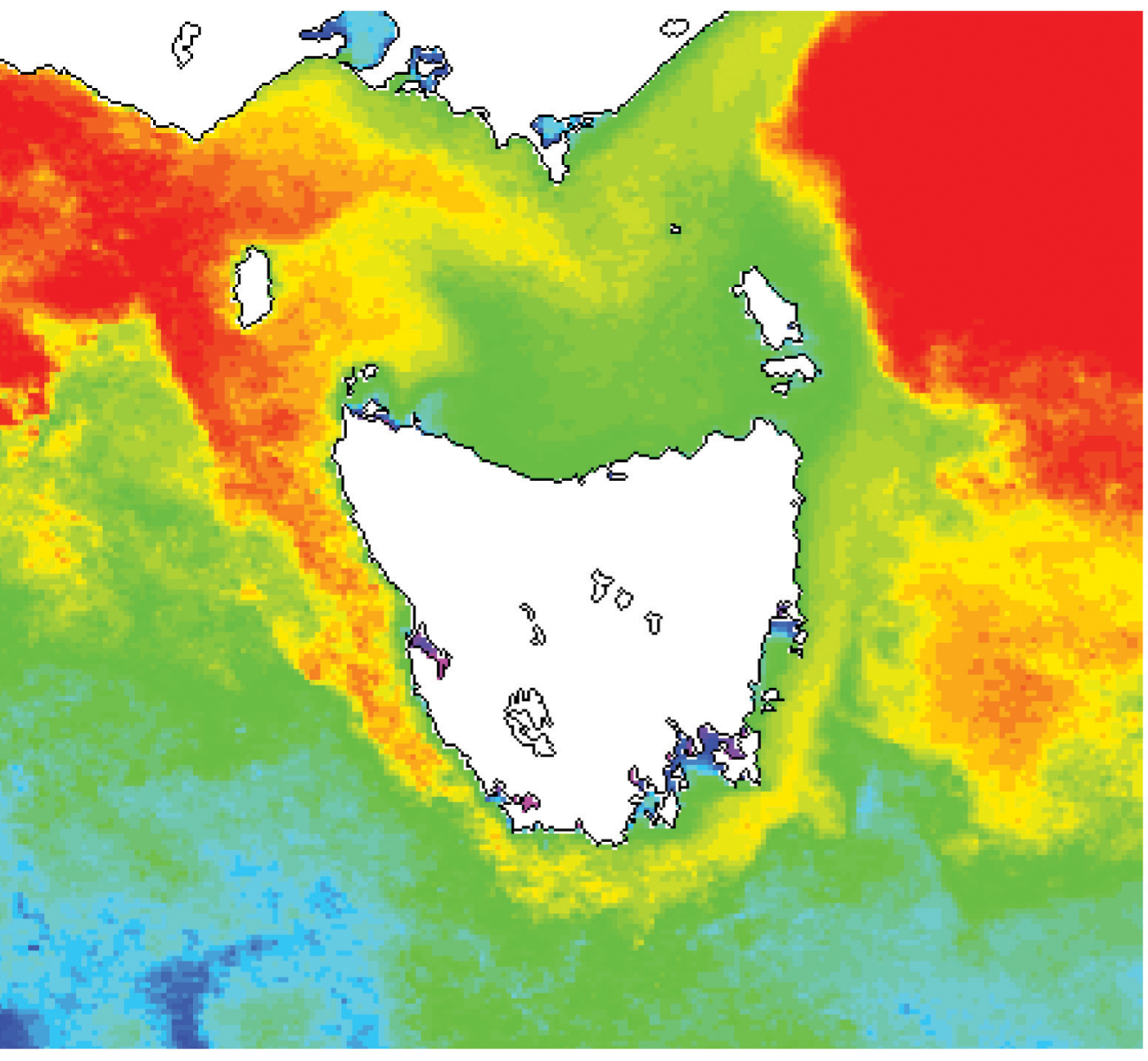
Image: CSIRO ScienceImage 10719 NOAA polar orbiting satellites obtain the data generating sea surface temperature images This is a composite 15day image showing the extension of the Leeuwin Current around Tasmania
Description: In 2009, Tasmania's east coast recorded its highest-ever winter water temperatures of more than 13ºC – up to 1.5ºC above normal – due to a strengthening of an ocean current originating north of Australia. Satellite imagery gave oceanographers an insight into a remarkable phenomenon – a significant extension of the Leeuwin Current curling around the southern tip of Tasmania and reaching as far north as St Helens. The Leeuwin Current forms north of Australia and flows right around the western half of the country, meeting its better known cousin, the East Australian Current (EAC), at Tasmania. The exact location of this meeting point varies both seasonally and from year-to-year, depending on how strongly each current is flowing. Oceanographers believe the EAC has gradually been getting stronger, and the Leeuwin Current weaker. Changes in the EAC are among the most significant in the global ocean, with a continuous record of monthly measu
Title: CSIRO ScienceImage 10719 NOAA polar orbiting satellites obtain the data generating sea surface temperature images This is a composite 15day image showing the extension of the Leeuwin Current around Tasmania
Credit: http://www.scienceimage.csiro.au/image/10719
Author: division, CSIRO
Permission: http://www.scienceimage.csiro.au/pages/about/
Usage Terms: Creative Commons Attribution 3.0
License: CC BY 3.0
License Link: https://creativecommons.org/licenses/by/3.0
Attribution Required?: Yes
Image usage
The following page links to this image:
