Image: Cafires vir 2021231 lrg

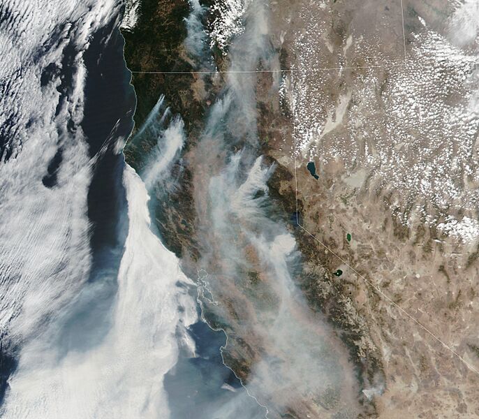
Description: On August 19, 2021, the Visible Infrared Imaging Radiometer Suite (VIIRS) on the NOAA-NASA Suomi NPP satellite acquired a natural-color image of fires raging in California. While smoke has often blown west in recent weeks, shifting winds have begun to darken skies in northern and central California, triggering air quality alerts in Sacramento and San Francisco. The Dixie fire, which was 35 percent contained as of August 20, has grown to become the second-largest fire on record in California. In addition to charring more than 1,000 square miles (2600 square kilometers), the blaze is responsible for the destruction of at least 1,225 structures, including hundreds of homes in Greenville, California. It recently crossed the crest of the Sierra Nevada—something California firefighters have never observed a fire doing before.
One of the newest and most worrisome fires was burning east of Sacramento. Though initially small, the Caldor fire exploded in size on August 16 as winds picked up, forcing thousands of people from their homes and destroying much of the town of Grizzly Flats. As of August 20, it was completely uncontained, according to Cal Fire.
Usage Terms: Public domain
Image usage
The following page links to this image:

